


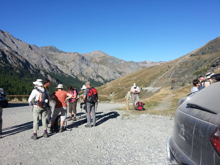
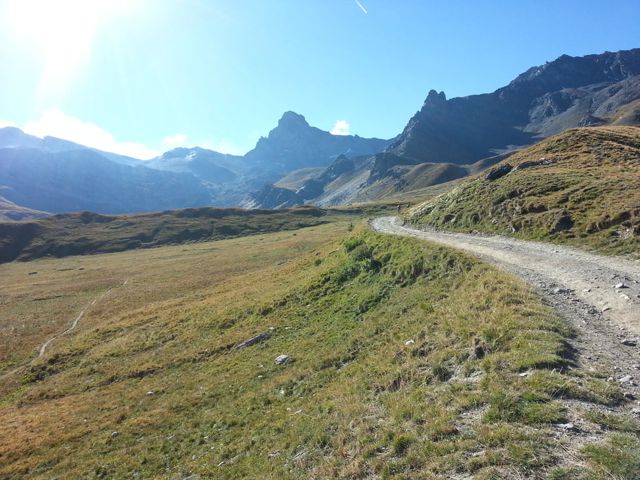
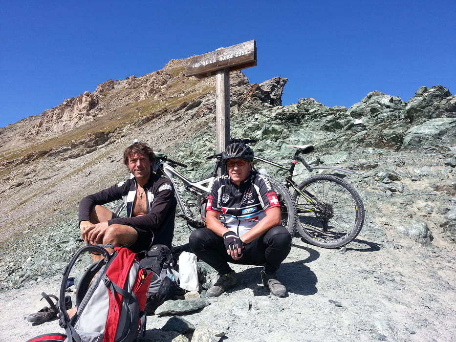
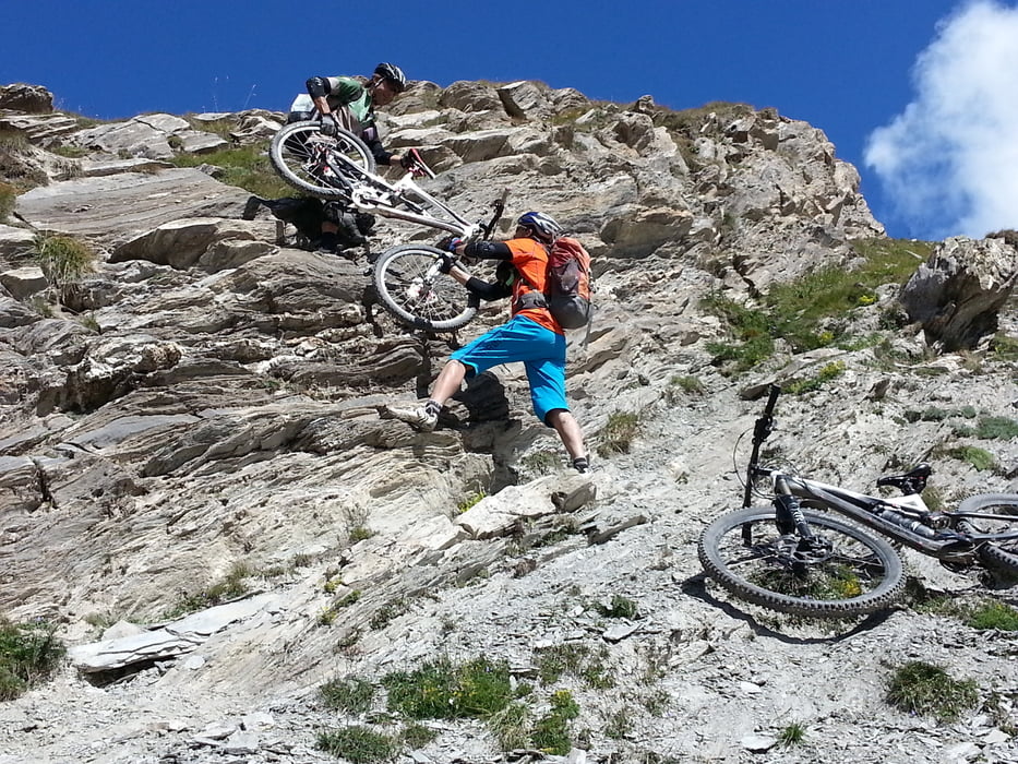
Früh morgens geht es in Saint Veran 2050m vom Hotel Alta Peyra**** los. Gleich hinter dem Ort wechselt die Straße auf eine gute Schotterpiste. Mit einigen steilen Rampen geht es bis Lac de la Blanche auf 2500m. Dort am See ist auch das Refuge de la Blanche, wo viele Wanderer und Mountenbiker Rast machen. Ich fahre aber gleich weiter und biege rechts ab zum Col de la Noire 2955m. Mit schieben und tragen benötige ich 80min bis zum Paß mit wunderbarer Aussicht. Ich treffe zwei andere Mtb die mir beim Abstieg an einer kleinen Felsbwand behilflich sind, das Fahrrad über zwei Stationen abzuseilen. Lang gezognes Tal L'Ubaye, im Refuge Maljasset 1920m machen ich mit den anderen beiden Mountenbiker Rast. Danach geht es auf Piste und Straße nach Saint-Paul-sur-Ubaye 1291m wo ich übernachte.
Further information at
http://www.ubaye.com/saint-paul-sur-ubaye.htmlGalerija izletov
Zemljevid in višinski profil izleta
Minimum height 1467 m
Maximum height 2957 m
More about the tour author
|
|
Sport2008 |
Komentarji

siehe Tour 126692. 1.Tag Westalpen-2013 Aussois 1500m-Bardonecchia 1312m
Poti GPS
Trackpoints-
GPX / Garmin Map Source (gpx) download
-
TCX / Garmin Training Center® (tcx) download
-
CRS / Garmin Training Center® (crs) download
-
Google Earth (kml) download
-
G7ToWin (g7t) download
-
TTQV (trk) download
-
Overlay (ovl) download
-
Fugawi (txt) download
-
Kompass (DAV) Track (tk) download
-
List z izleti (pdf) download
-
Original file of the author (gpx) download
More about the tour author
|
|
Sport2008 |
Add to my favorites
Remove from my favorites
Edit tags
Open track
My score
Rate