


Rif. Fedare-Rif. Averau-Rif. Scoiattoli-Rif. 5 Torri-
Rif. Duca d'Aosta-Pocol-Ronco-Cortina-Rif. Mietres-Cortina
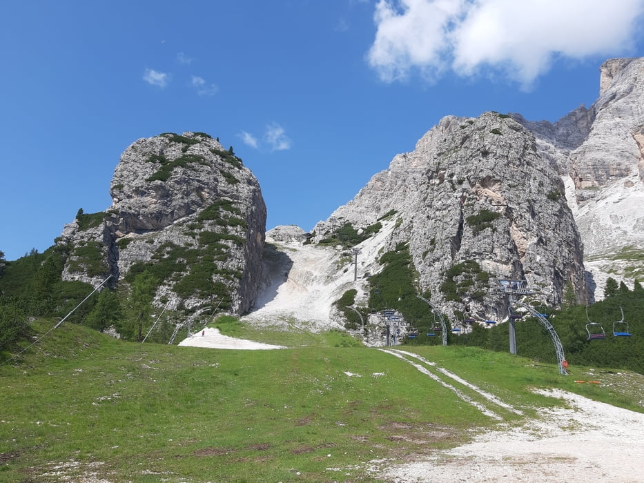
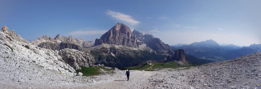
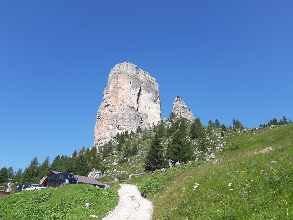
Wieder dem Schlechtwetter geschuldete "nur" Halbtagestour. Allerdings in spektakulärer Kulisse! (mit 2 Abstechern) Gleich zu Beginn ein sehr steiler und grobschottriger Anstieg zum Rif Averau (ein wenig ist auch fahrbar): 1h. Oben tut sich die Welt der Dolomiten in all ihrer Pracht auf! Irgendwie will ich da nicht mehr weg… Fotosession hilft. Runter steil und grobschottrig zum Rif. Scoiattoli und weiter zum Rif. 5 Torri - fahrbar. Ab da eine schmale Asphaltstraße. Achtung: da kommen viele italienische Tagesausflügler mit dem Auto hoch! Nach einigen 100 hm trifft man auf die strada statale: noch mehr Verkehr, aber auch mehr Platz. Nach ein paar km nehme ich die Abzweigung zum Rif. Duca d'Aosta, weil ich meine, dort ruhiger nach Cortina zu kommen. Leider ist der Weg wegen Pistenarbeiten nicht frei. Dafür sehe ich den berüchtigten Tofana-Schuss aus unmittelbarer Nähe: sehr beeindruckend. Zurück auf die SS und runter nach Cortina. Nach einer Rast rauf zum Rif Mietres, da setzt der Regen ein. Leider haben sie da keine Übernachtungsmöglichkeit, aber die Wirtsleute sind SEHR nett und helfen mir bei der Quartiersuche. Michele Menardi (Ex-Bobfahrer!) telefoniert für mich ein Quartier nach dem anderen an. Am Ende bleibt wohl oder übel nichts anderes übrig als die Rückkehr nach Cortina (ca 350 hm). Quartier: Hotel Menardi (nicht verwandt!) NF 80€, sehr gut.
Wieder dem Schlechtwetter geschuldete "nur" Halbtagestour. Allerdings in spektakulärer Kulisse! (mit 2 Abstechern) Gleich zu Beginn ein sehr steiler und grobschottriger Anstieg zum Rif Averau (ein wenig ist auch fahrbar): 1h. Oben tut sich die Welt der Dolomiten in all ihrer Pracht auf! Irgendwie will ich da nicht mehr weg… Fotosession hilft. Runter steil und grobschottrig zum Rif. Scoiattoli und weiter zum Rif. 5 Torri - fahrbar. Ab da eine schmale Asphaltstraße. Achtung: da kommen viele italienische Tagesausflügler mit dem Auto hoch! Nach einigen 100 hm trifft man auf die strada statale: noch mehr Verkehr, aber auch mehr Platz. Nach ein paar km nehme ich die Abzweigung zum Rif. Duca d'Aosta, weil ich meine, dort ruhiger nach Cortina zu kommen. Leider ist der Weg wegen Pistenarbeiten nicht frei. Dafür sehe ich den berüchtigten Tofana-Schuss aus unmittelbarer Nähe: sehr beeindruckend. Zurück auf die SS und runter nach Cortina. Nach einer Rast rauf zum Rif Mietres, da setzt der Regen ein. Leider haben sie da keine Übernachtungsmöglichkeit, aber die Wirtsleute sind SEHR nett und helfen mir bei der Quartiersuche. Michele Menardi (Ex-Bobfahrer!) telefoniert für mich ein Quartier nach dem anderen an. Am Ende bleibt wohl oder übel nichts anderes übrig als die Rückkehr nach Cortina (ca 350 hm). Quartier: Hotel Menardi (nicht verwandt!) NF 80€, sehr gut.
Further information at
https://www.hotelmenardi.it/de/?utm_source=google&utm_medium=organic&utm_campaign=GoogleMyBusinessGalerija izletov

Zemljevid in višinski profil izleta
Minimum height 1234 m
Maximum height 2417 m
More about the tour author
|
|
mitter |
Komentarji

Start beim Rif. Fedare unterm Passo Giau.
Poti GPS
Trackpoints-
GPX / Garmin Map Source (gpx) download
-
TCX / Garmin Training Center® (tcx) download
-
CRS / Garmin Training Center® (crs) download
-
Google Earth (kml) download
-
G7ToWin (g7t) download
-
TTQV (trk) download
-
Overlay (ovl) download
-
Fugawi (txt) download
-
Kompass (DAV) Track (tk) download
-
List z izleti (pdf) download
-
Original file of the author (gpx) download
More about the tour author
|
|
mitter |
Add to my favorites
Remove from my favorites
Edit tags
Open track
My score
Rate