Login

Si pozabil/a podatke za prijavo?

Cookies have to be accepted!
Your browser's cookie functionality is disabled. Please enable this functionality.

Not a member yet?

Register now
Login

Available for registred users only

Log in to use this feature.

Si pozabil/a podatke za prijavo?

Cookies have to be accepted!
Your browser's cookie functionality is disabled. Please enable this functionality.

Not a member yet?

Register now
Filter
Kategorije
Advanced filters
  • Dolžina (km)
  • Metri nadmorske višine
Shrani filter Reset filter

TrackRank

QRCode

Technical data

Dolžina21,1 km Metri nadmorske višine345 m Way down339 m Trajanje02:00 h:m Datum19.04.2020
Ocene Author Pokrajina Dejavnik zabave Kondicija Tehnika

Statistika

114 Pogledi Ocene 14 Prenosi Povprečje
Rate
  • List z izleti
  • Prihod
  • Prenosi

Es wird wieder in Kalteneck am Bahnhof gestartet,

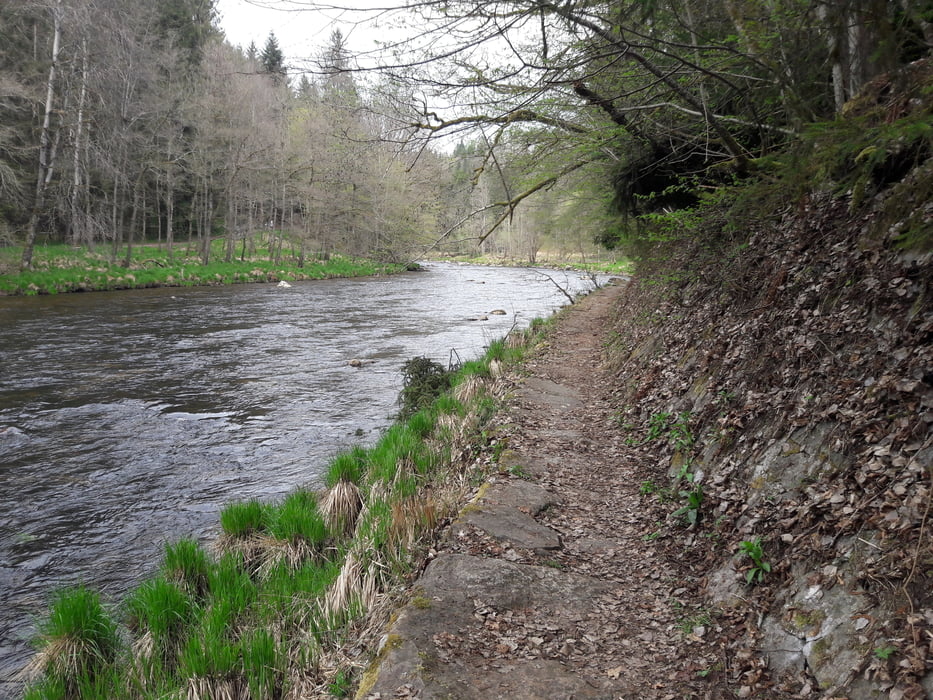
von dort geht es links der Ilz an leichten Trails richtung Kleinthannensteig.

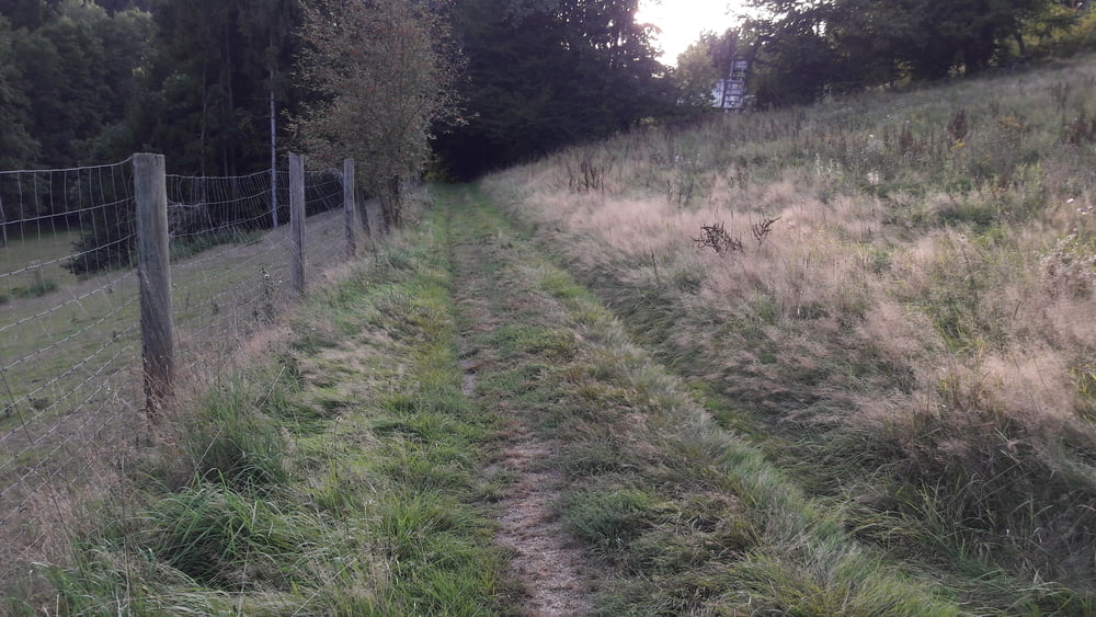
Nun folgt eine kurze aber steile Rampe auf einem Forstweg.Ein kurzes Stpck nun auf einer Seitenstrasse und weiter geht es auf leichten Trails richtung Ilz / Fischhaus. Weiter über die Ilzbrücke und danach rechts ab kurz auf der Teerstrasse in weiter dann links in einen Waldweg richtung Russmühle.Weiter gehts im Wald richtung Irlmühle,Wullersdorf Richtung Sickenthal.

ein paar Meter auf Nebenstrasse richtung Richting und von dort geht es einen tollen Trail Richtung Ilz. Jetzt gemütlich am Wanderweg Richtung Kalteneck und von dort aus bleiben wir auf der rechten Seite der Ilz und fahren noch Richtung aumühle, dort über die Brück und auf der anderen Seite zurück nach Kalteneck

nur für MTB geeignet

Galerija izletov

Zemljevid in višinski profil izleta

  • Open Street Map
  • Google
Minimum height 62 m Maximum height 213 m Prikaz podrobnosti

More about the tour author

franz1962
Member since 2011

Send private message

Komentarji

Poti GPS

Trackpoints
  • GPX / Garmin Map Source (gpx) download
  • TCX / Garmin Training Center® (tcx) download
  • CRS / Garmin Training Center® (crs) download
  • Google Earth (kml) download
  • G7ToWin (g7t) download
  • TTQV (trk) download
  • Overlay (ovl) download
  • Fugawi (txt) download
  • Kompass (DAV) Track (tk) download
  • List z izleti (pdf) download
  • Original file of the author (gpx) download

More about the tour author

franz1962
Member since 2011

Send private message
Share track
Add to my favorites
Remove from my favorites
Edit tags
My score
Rate
Izlet: Hutthurm_Kleintannensteig_Fischhaus_Grubhof_Aumühle
Vrsta: Gorsko kolo
Dolžina: 21,1 km
Evaluated on:
Trajanje:
Day(s)
Hour(s)
Minute(s)
Ocena: Pokrajina Dejavnik zabave Kondicija Tehnika