Login

Si pozabil/a podatke za prijavo?

Cookies have to be accepted!
Your browser's cookie functionality is disabled. Please enable this functionality.

Not a member yet?

Register now
Login

Available for registred users only

Log in to use this feature.

Si pozabil/a podatke za prijavo?

Cookies have to be accepted!
Your browser's cookie functionality is disabled. Please enable this functionality.

Not a member yet?

Register now
Filter
Kategorije
Advanced filters
  • Dolžina (km)
  • Metri nadmorske višine
Shrani filter Reset filter

TrackRank

QRCode

Technical data

Dolžina23,6 km Metri nadmorske višine699 m Way down701 m Trajanje03:20 h:m Datum22.08.2021
Ocene Author Pokrajina Dejavnik zabave Kondicija Tehnika

Statistika

192 Pogledi Ocene 32 Prenosi Povprečje
Rate
  • List z izleti
  • Prihod
  • Prenosi

Vom Fährhafen auf der Insel Cres geht es Richtung "Ortsmitte" Merag, wobei Merag lediglich aus ein paar Häusern besteht. Auf einer Teer-Sackgasse geht es an einigen Häusern vorbeit bld steil in den Wald hinein. Diese Strecke ist regelnäßig eine MTB-Wettkampfstecke. Bis auf wenige Schiebepassagen ist sie aber fahrbar und macht Spaß. Stellenweise fährt man auch auf Teerfragmenten.

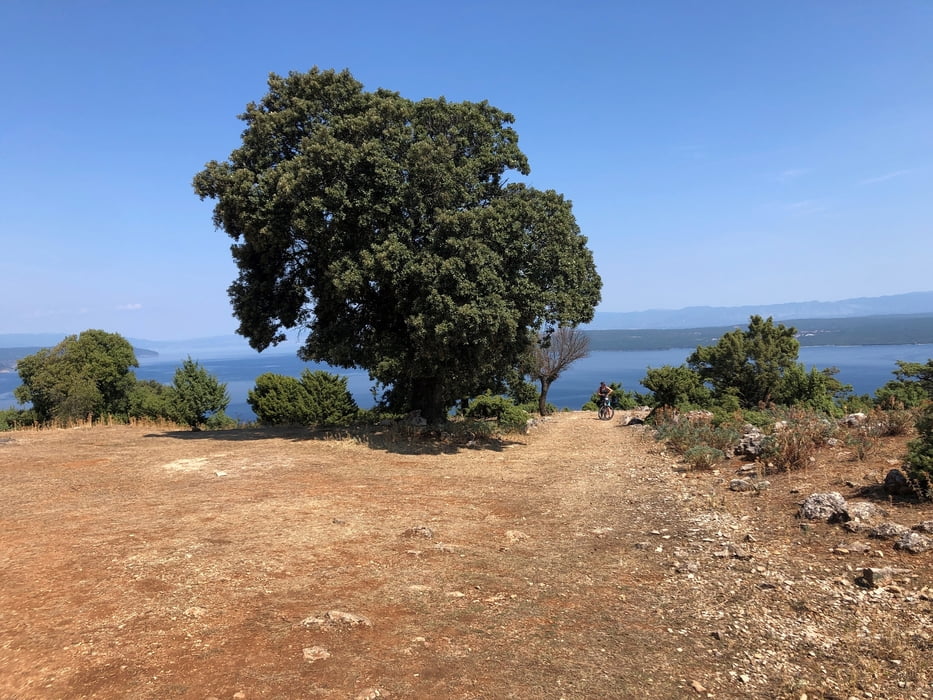
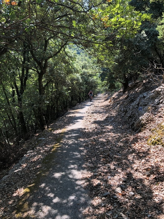
Kurz vor dem höchsten Punkt trifft man auf eine wunderschöne Lichtung. In der Abfahrt überquert man kurz die Straße um bald wieder in den Trail einzusteigen. Die Abfahrt auf dem Trail macht unheimlich Spaß.

Zurück sind wir dann über die Straße. Nervig mit vielen rücksichtslosen Autofahrern, aber zeitsparend.

Einschränkungen

This tour has a carry or push section on 0.5 kilometers

Galerija izletov

Zemljevid in višinski profil izleta

  • Open Street Map
  • Google
Minimum height -6 m Maximum height 327 m Prikaz podrobnosti

More about the tour author

sr2
Member since 2020

Send private message

Komentarji

Mit der Fähre von Krk nach Merag auf der Insel Cres.

Einschränkungen

This tour has a carry or push section on 0.5 kilometers

Poti GPS

Trackpoints
  • GPX / Garmin Map Source (gpx) download
  • TCX / Garmin Training Center® (tcx) download
  • CRS / Garmin Training Center® (crs) download
  • Google Earth (kml) download
  • G7ToWin (g7t) download
  • TTQV (trk) download
  • Overlay (ovl) download
  • Fugawi (txt) download
  • Kompass (DAV) Track (tk) download
  • List z izleti (pdf) download
  • Original file of the author (gpx) download

More about the tour author

sr2
Member since 2020

Send private message
Share track
Add to my favorites
Remove from my favorites
Edit tags
My score
Rate
Izlet: Trail Merag-Cres und über die Straße zurück
Vrsta: Gorsko kolo
Dolžina: 23,6 km
Evaluated on:
Trajanje:
Day(s)
Hour(s)
Minute(s)
Ocena: Pokrajina Dejavnik zabave Kondicija Tehnika