Login

Si pozabil/a podatke za prijavo?

Cookies have to be accepted!
Your browser's cookie functionality is disabled. Please enable this functionality.

Not a member yet?

Register now
Login

Available for registred users only

Log in to use this feature.

Si pozabil/a podatke za prijavo?

Cookies have to be accepted!
Your browser's cookie functionality is disabled. Please enable this functionality.

Not a member yet?

Register now
Filter
Kategorije
Advanced filters
  • Dolžina (km)
  • Metri nadmorske višine
Shrani filter Reset filter

TrackRank

QRCode

Technical data

Dolžina10,9 km Metri nadmorske višine165 m Way down142 m Trajanje02:45 h:m Datum07.11.2022
Ocene Author Pokrajina Dejavnik zabave Kondicija Tehnika

Statistika

149 Pogledi Ocene 2 Prenosi Povprečje
Rate
  • List z izleti
  • Prihod
  • Prenosi
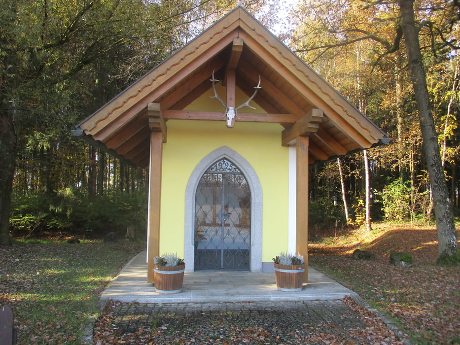
Vom Startplatz geht es in östlicher Richtung flach bis Untersinnersdorf. Ein Stück entlang des Weyerbaches. Dann in südlicher Richtung über Unter- und Obergrassing nach Oberndorf und vorbei an der Hubertuskapelle zurück ins Ortszentrum.

Galerija izletov

Zemljevid in višinski profil izleta

  • Open Street Map
  • Google
Minimum height 322 m Maximum height 426 m Prikaz podrobnosti

More about the tour author

JoHangler
Member since 2013

Send private message

Komentarji

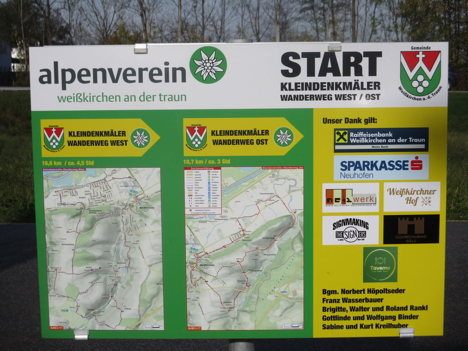
Über die Autobahnabfahrten Marchtrenk oder Allhaming. Der Parkplatz liegt an der Straße vom Eurospar (Traunuferweg) nördlich der Kirche.
Auch mit öffentl. Verkehrsmitteln ist Weißkirchen regelmäßig gut erreichbar (ooevv.at).

Poti GPS

Trackpoints
  • GPX / Garmin Map Source (gpx) download
  • TCX / Garmin Training Center® (tcx) download
  • CRS / Garmin Training Center® (crs) download
  • Google Earth (kml) download
  • G7ToWin (g7t) download
  • TTQV (trk) download
  • Overlay (ovl) download
  • Fugawi (txt) download
  • Kompass (DAV) Track (tk) download
  • List z izleti (pdf) download
  • Original file of the author (gpx) download

More about the tour author

JoHangler
Member since 2013

Send private message
Share track
Add to my favorites
Remove from my favorites
Edit tags
My score
Rate
Izlet: Kleindenkmälerwanderweg Ost Weißkirchen a.d. Traun
Vrsta: Pešačenje
Dolžina: 10,9 km
Evaluated on:
Trajanje:
Day(s)
Hour(s)
Minute(s)
Ocena: Pokrajina Dejavnik zabave Kondicija Tehnika