Login

Si pozabil/a podatke za prijavo?

Cookies have to be accepted!
Your browser's cookie functionality is disabled. Please enable this functionality.

Not a member yet?

Register now
Login

Available for registred users only

Log in to use this feature.

Si pozabil/a podatke za prijavo?

Cookies have to be accepted!
Your browser's cookie functionality is disabled. Please enable this functionality.

Not a member yet?

Register now
Filter
Kategorije
Advanced filters
  • Dolžina (km)
  • Metri nadmorske višine
Shrani filter Reset filter

TrackRank

QRCode

Technical data

Dolžina13,6 km Metri nadmorske višine507 m Way down385 m Trajanje04:15 h:m Datum31.05.2023
Ocene Author Pokrajina Dejavnik zabave Kondicija Tehnika

Statistika

181 Pogledi Ocene 2 Prenosi Povprečje
Rate
  • List z izleti
  • Prihod
  • Prenosi

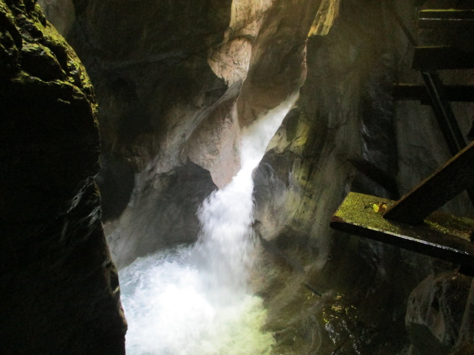
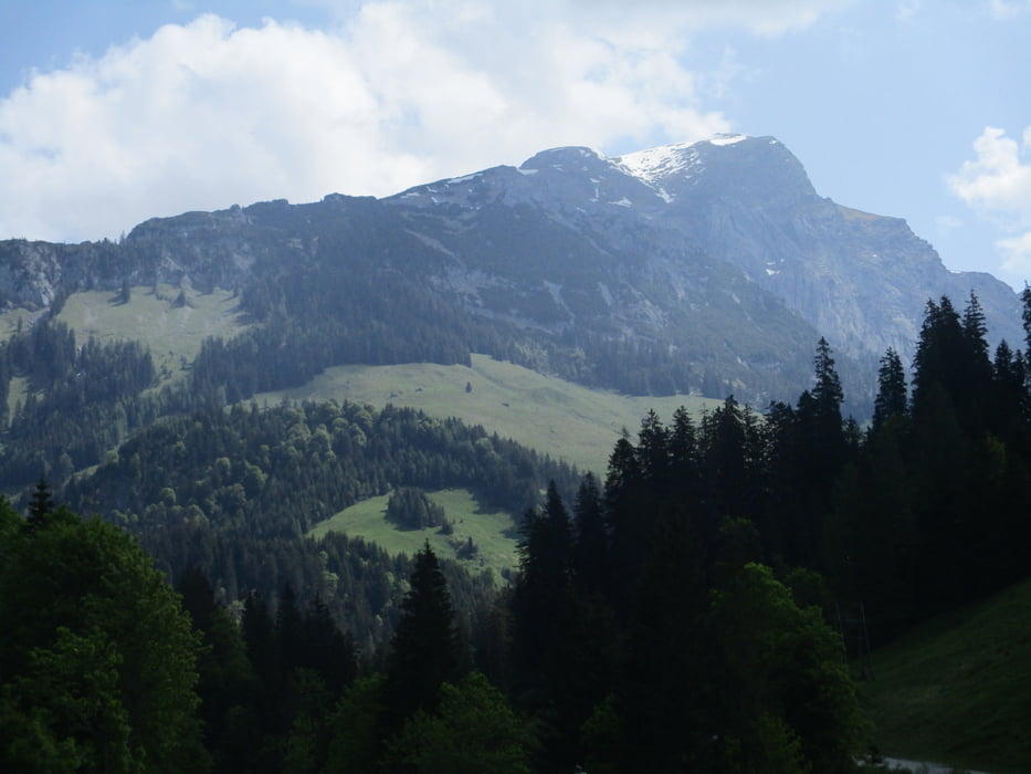
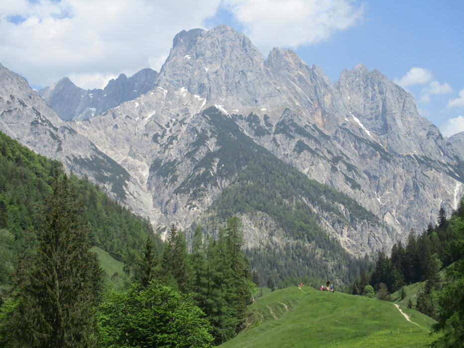
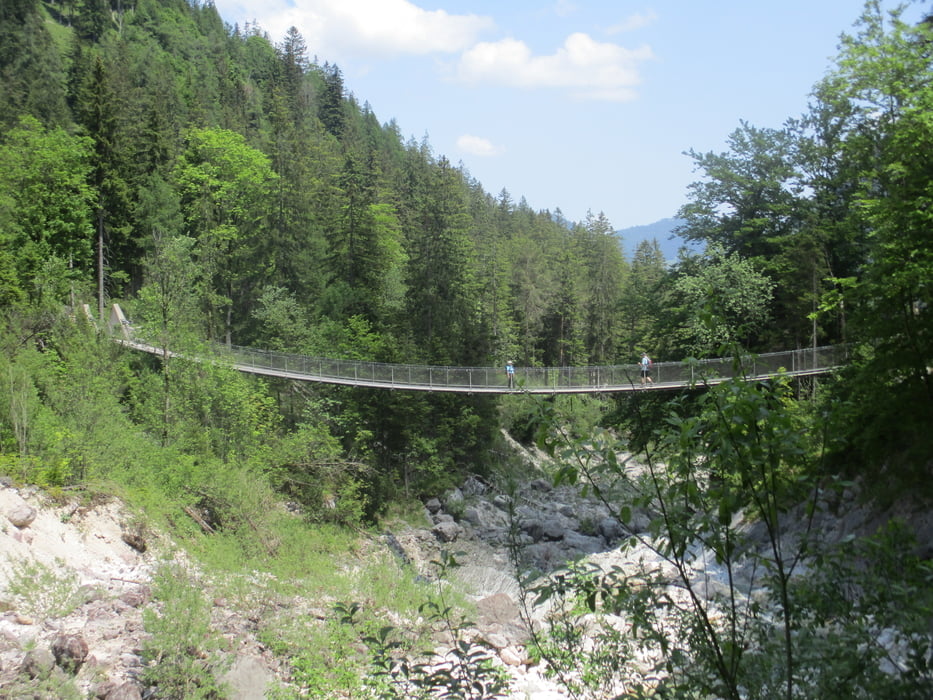
Vom Gemeindeamt durch die beeindruckende Seisenbergklamm hinauf zum GH Lohfeyer und weiter nach Hintertal. Auf dem Hirschbichl wird die Grenze zwischen Österreich und Deutschland erreicht und kurz darauf beim ehemaligen Zollamt das GH Hirschbichl (aktuell DI und MI Ruhetag). Ein kurzes Stück hinunter zur Bindalm und durch das "Tal der Adler" über die spektakuläre Hängebrücke und hinaus nach Hintersee.

Die Rückkehr erfolgt mit dem Tälerbus.

Galerija izletov

Zemljevid in višinski profil izleta

  • Open Street Map
  • Google
Minimum height 695 m Maximum height 1182 m Prikaz podrobnosti

More about the tour author

JoHangler
Member since 2013

Send private message

Komentarji

Auf der B311 von Lofer oder Zell am See nach Weißbach.

Es kann genauso gut von Hintersee aus gestartet werden.

Poti GPS

Trackpoints
  • GPX / Garmin Map Source (gpx) download
  • TCX / Garmin Training Center® (tcx) download
  • CRS / Garmin Training Center® (crs) download
  • Google Earth (kml) download
  • G7ToWin (g7t) download
  • TTQV (trk) download
  • Overlay (ovl) download
  • Fugawi (txt) download
  • Kompass (DAV) Track (tk) download
  • List z izleti (pdf) download
  • Original file of the author (gpx) download

More about the tour author

JoHangler
Member since 2013

Send private message
Share track
Add to my favorites
Remove from my favorites
Edit tags
My score
Rate
Izlet: Durch die Seisenbergklamm zum Hirschbichl und nach Hintersee
Vrsta: Pešačenje
Dolžina: 13,6 km
Evaluated on:
Trajanje:
Day(s)
Hour(s)
Minute(s)
Ocena: Pokrajina Dejavnik zabave Kondicija Tehnika