Login

Si pozabil/a podatke za prijavo?

Cookies have to be accepted!
Your browser's cookie functionality is disabled. Please enable this functionality.

Not a member yet?

Register now
Login

Available for registred users only

Log in to use this feature.

Si pozabil/a podatke za prijavo?

Cookies have to be accepted!
Your browser's cookie functionality is disabled. Please enable this functionality.

Not a member yet?

Register now
Filter
Kategorije
Advanced filters
  • Dolžina (km)
  • Metri nadmorske višine
Shrani filter Reset filter

TrackRank

QRCode

Technical data

Dolžina27,9 km Metri nadmorske višine1469 m Way down1745 m Trajanje07:00 h:m Datum01.11.2005
Ocene Author User Pokrajina Dejavnik zabave Kondicija Tehnika

Statistika

5171 Pogledi 5 Ocene 581 Prenosi 4.60 Povprečje
Rate
  • List z izleti
  • Prihod
  • Prenosi

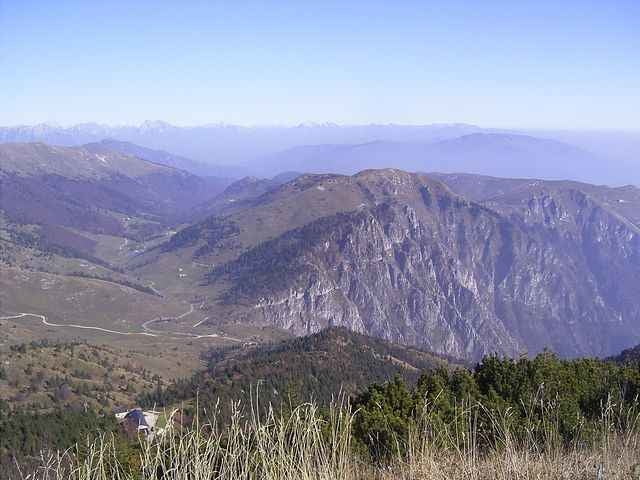
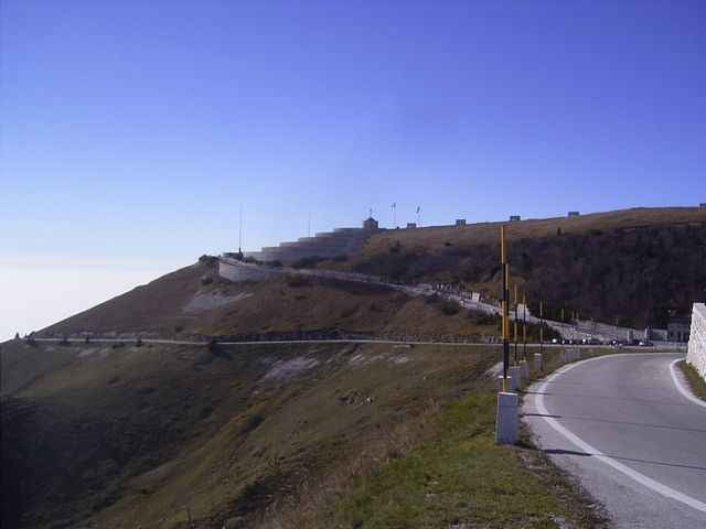
Tour on old donkey way from Bassano del Grappa - Crespano - Modonna del Cavallo to the Mt. Grappa monument (1st world war). 


 The way down is going along a trail along the mountain top with some small walking passages, than on a spectacular trail cut into the mountain with spectacular view!. The way down to San Liberale is the sentiero 153 (S1-S2 level), a good biker can drive nearly everything, but be carefull in driving, the way is most of the time small and cut into the mountain.

  If you find the sentiero 153 to difficult, in about 3km is a easy way down to  San Liberale S0
 

August 2012 - track erneurert - Auffahrt nun komplett fahrbar

Galerija izletov

Zemljevid in višinski profil izleta

  • Open Street Map
  • Google
Minimum height 287 m Maximum height 1734 m Prikaz podrobnosti

More about the tour author

skyhopper
Member since 2005

Send private message

Komentarji

Checco on 21.12.2006

Error on the description

The sentiero of the way down in the track is not the CAI 151. I have do it, with my gps and the track of this tour does not corrisponding with my track (i have a photo of the real sentiero 151 too): http://81.208.98.134/FotoMountainBike/2006-12-17%20Grappa-cai%20151%20800x600/index.htm
I think that the sentiero in the track of this tour is the CAI 150. Next time that i going in the Monte Grappa, i'll do it.
Checco on 27.12.2006

Finally, I just do it. You have do the sentiero CAI 153 and i have found it VERY nice ! It's very spectacular. Thank you for this. I have same photo of it:
http://172.16.1.2/FotoMountainBike/2006-12-23%20Grappa%20Cai153%20800x600/index.htm
Trento on SS47 until exit Bssano, left to Romano Ezellino and Crespano. In Crespano on the traffic light left to Madonno di Cavallo church.

Poti GPS

Trackpoints
  • GPX / Garmin Map Source (gpx) download
  • TCX / Garmin Training Center® (tcx) download
  • CRS / Garmin Training Center® (crs) download
  • Google Earth (kml) download
  • G7ToWin (g7t) download
  • TTQV (trk) download
  • Overlay (ovl) download
  • Fugawi (txt) download
  • Kompass (DAV) Track (tk) download
  • List z izleti (pdf) download
  • Original file of the author (gpx) download

More about the tour author

skyhopper
Member since 2005

Send private message
Share track
Add to my favorites
Remove from my favorites
Edit tags
My score
Rate
Izlet: Veneto: Bassano del Grappa - Crespano - Mt Grappa 1760m sentiero 153
Vrsta: Gorsko kolo
Dolžina: 27,9 km
Evaluated on:
Trajanje:
Day(s)
Hour(s)
Minute(s)
Ocena: Pokrajina Dejavnik zabave Kondicija Tehnika