Login

Si pozabil/a podatke za prijavo?

Cookies have to be accepted!
Your browser's cookie functionality is disabled. Please enable this functionality.

Not a member yet?

Register now
Login

Available for registred users only

Log in to use this feature.

Si pozabil/a podatke za prijavo?

Cookies have to be accepted!
Your browser's cookie functionality is disabled. Please enable this functionality.

Not a member yet?

Register now
Filter
Kategorije
Advanced filters
  • Dolžina (km)
  • Metri nadmorske višine
Shrani filter Reset filter

TrackRank

QRCode

Technical data

Dolžina13,6 km Metri nadmorske višine445 m Way down426 m Trajanje04:00 h:m Datum28.03.2009
Ocene Author Pokrajina Dejavnik zabave Kondicija Tehnika

Statistika

1380 Pogledi Ocene 112 Prenosi Povprečje
Rate
  • List z izleti
  • Prihod
  • Prenosi

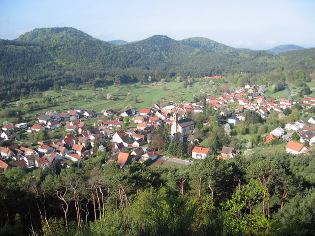
Start beim Kirchplatz Birkenhördt. Gute Park- und Einkehrmöglichkeit.

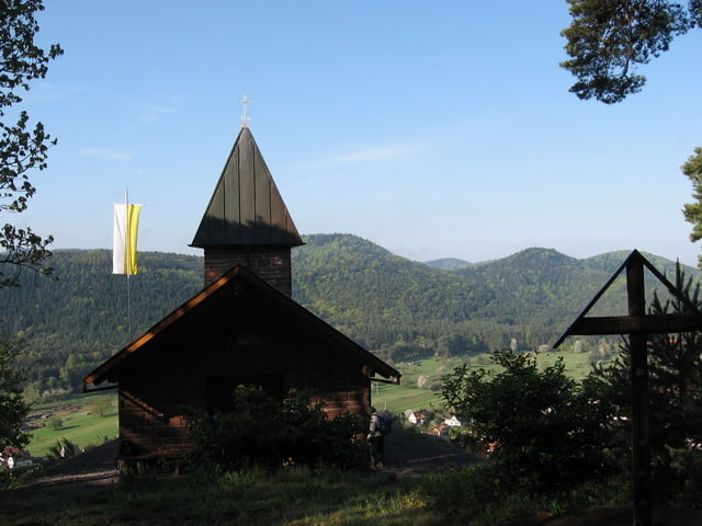
Aufstieg zur sehenswerten Kapelle mit schöner Aussicht.

Rastmöglichkeit bei der Silzer Linde mit Hütte.

Bemerkung: etwa die Hälfte der Tour ohne Wanderzeichen


Further information at

http://www.birkenhoerdt.de/

Galerija izletov

Zemljevid in višinski profil izleta

  • Open Street Map
  • Google
Minimum height 210 m Maximum height 399 m Prikaz podrobnosti

More about the tour author

Reinholdo
Member since 2008

Send private message

Komentarji

Mit Rad, Bahn bis Bad Bergzabern, Bus oder Auto.

Ab Bad Bergzabern auf der B 427 Richtung Dahn.

Poti GPS

Trackpoints
  • GPX / Garmin Map Source (gpx) download
  • TCX / Garmin Training Center® (tcx) download
  • CRS / Garmin Training Center® (crs) download
  • Google Earth (kml) download
  • G7ToWin (g7t) download
  • TTQV (trk) download
  • Overlay (ovl) download
  • Fugawi (txt) download
  • Kompass (DAV) Track (tk) download
  • List z izleti (pdf) download
  • Original file of the author (gpx) download

More about the tour author

Reinholdo
Member since 2008

Send private message
Share track
Add to my favorites
Remove from my favorites
Edit tags
My score
Rate
Izlet: Birkenhördt Rundtour
Vrsta: Pešačenje
Dolžina: 13,6 km
Evaluated on:
Trajanje:
Day(s)
Hour(s)
Minute(s)
Ocena: Pokrajina Dejavnik zabave Kondicija Tehnika