Login

Si pozabil/a podatke za prijavo?

Cookies have to be accepted!
Your browser's cookie functionality is disabled. Please enable this functionality.

Not a member yet?

Register now
Login

Available for registred users only

Log in to use this feature.

Si pozabil/a podatke za prijavo?

Cookies have to be accepted!
Your browser's cookie functionality is disabled. Please enable this functionality.

Not a member yet?

Register now
Filter
Kategorije
Advanced filters
  • Dolžina (km)
  • Metri nadmorske višine
Shrani filter Reset filter

TrackRank

QRCode

Technical data

Dolžina13,3 km Metri nadmorske višine1211 m Way down1122 m Trajanje04:15 h:m Datum13.10.2011
Ocene Author Pokrajina Dejavnik zabave Kondicija Tehnika

Statistika

3669 Pogledi Ocene 110 Prenosi Povprečje
Rate
  • List z izleti
  • Prihod
  • Prenosi
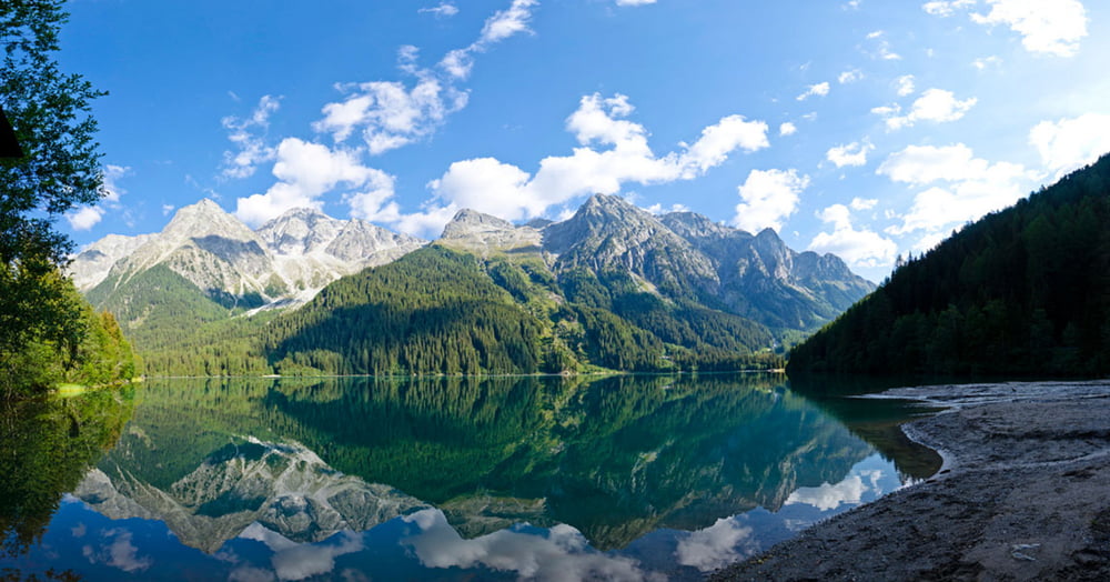
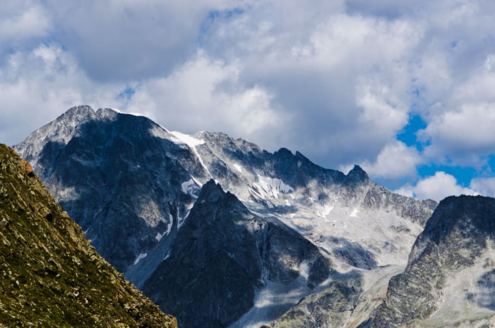
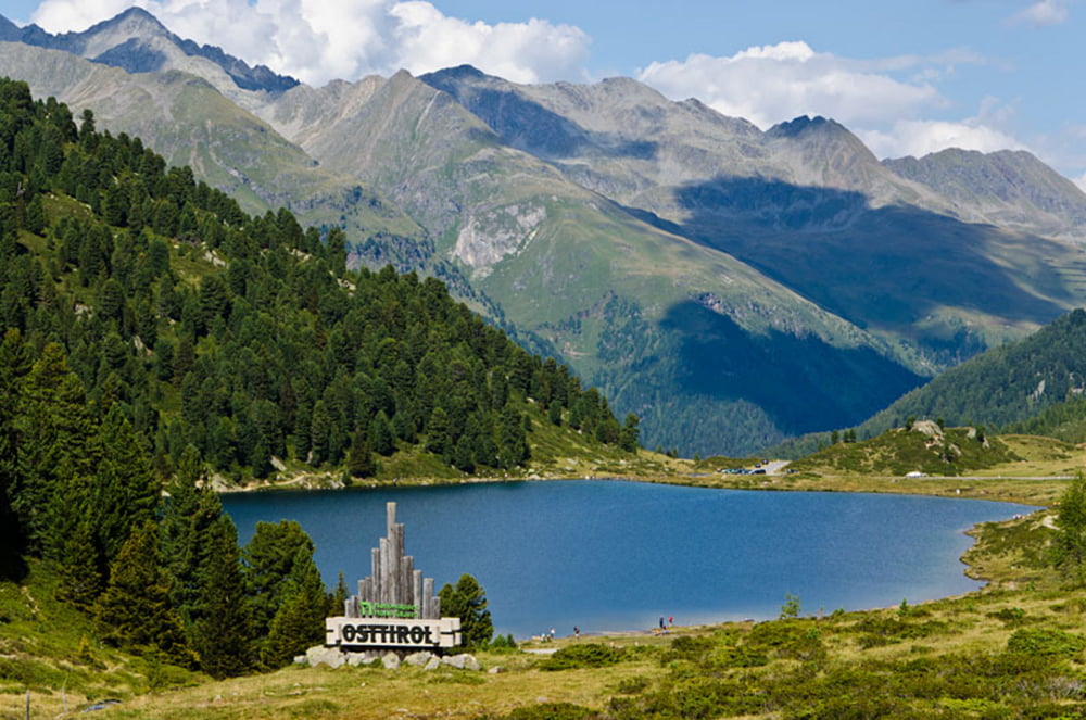
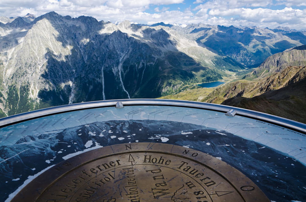
Vom Antholzer See in östlicher Richtung durch Wald hinauf zur Oberen Steinzgeralm. Anschließend entlang des Montalbaches über karges Gelände bis zum Fuß der Antholzer Rotwand. Der Aufstieg zum Gipfelkreuz erfolgt über Geröll und Blockgestein. Auf dem Gipfel der Rotwand liefert ein Panoramatisch die Namen der umliegenden Gipfel des Naturparks Riesenferner Ahrn, der Zillertaler Alpen, der Ötztaler Alpen, des Tauernhauptkammes, der Lienzer Dolomiten, der Karnischen Alpen und der Dolomiten. Der Abstieg erfolgt über Steig Nr. 7 hinunter durch das Agstal zum Staller Sattel und von dort weiter bis zum Ausgangspunkt am Antholzer See.

Further information at

http://www.diewanderer.it/antholzer-tal-rotwand/

Galerija izletov

Zemljevid in višinski profil izleta

  • Open Street Map
  • Google
Minimum height 1596 m Maximum height 2819 m Prikaz podrobnosti

More about the tour author

dimizu
Member since 2008

Send private message

Komentarji

Durch das Pustertal hindurch ins Antholzer Tal (Richtung Staller Sattel, Grenzübergang zu Österreich) bis zum Antholzer See, wo es auch genügend Stellplätze für PKW gibt.

Poti GPS

Trackpoints
  • GPX / Garmin Map Source (gpx) download
  • TCX / Garmin Training Center® (tcx) download
  • CRS / Garmin Training Center® (crs) download
  • Google Earth (kml) download
  • G7ToWin (g7t) download
  • TTQV (trk) download
  • Overlay (ovl) download
  • Fugawi (txt) download
  • Kompass (DAV) Track (tk) download
  • List z izleti (pdf) download
  • Original file of the author (gpx) download

More about the tour author

dimizu
Member since 2008

Send private message
Share track
Add to my favorites
Remove from my favorites
Edit tags
My score
Rate
Izlet: Antholzer Rotwand im Naturpark Riesenferner Ahrn
Vrsta: Pešačenje
Dolžina: 13,3 km
Evaluated on:
Trajanje:
Day(s)
Hour(s)
Minute(s)
Ocena: Pokrajina Dejavnik zabave Kondicija Tehnika