Login

Si pozabil/a podatke za prijavo?

Cookies have to be accepted!
Your browser's cookie functionality is disabled. Please enable this functionality.

Not a member yet?

Register now
Login

Available for registred users only

Log in to use this feature.

Si pozabil/a podatke za prijavo?

Cookies have to be accepted!
Your browser's cookie functionality is disabled. Please enable this functionality.

Not a member yet?

Register now
Filter
Kategorije
Advanced filters
  • Dolžina (km)
  • Metri nadmorske višine
Shrani filter Reset filter

TrackRank

QRCode

Technical data

Dolžina9,5 km Metri nadmorske višine530 m Way down2 m Trajanje03:00 h:m Datum06.03.2012
Ocene Author Pokrajina Dejavnik zabave Kondicija Tehnika

Statistika

636 Pogledi Ocene 42 Prenosi Povprečje
Rate
  • List z izleti
  • Prihod
  • Prenosi

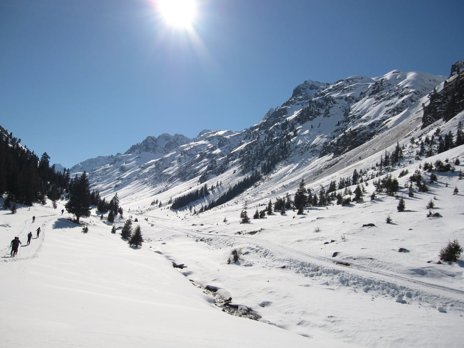
Zustieg zur Jamtalhütte von Galtür aus.

Im Mittelteil folgt der Track für ein paar hundert Meter nicht dem Fahrweg, da auf der Westseite des Tals Lawinengefahr herrschte.


Galerija izletov

Zemljevid in višinski profil izleta

  • Open Street Map
  • Google
Minimum height 1635 m Maximum height 2167 m Prikaz podrobnosti

More about the tour author

derwolf
Member since 2006

Send private message

Komentarji

Über Landeck und Ischgl nach Galtür.

Poti GPS

Trackpoints
  • GPX / Garmin Map Source (gpx) download
  • TCX / Garmin Training Center® (tcx) download
  • CRS / Garmin Training Center® (crs) download
  • Google Earth (kml) download
  • G7ToWin (g7t) download
  • TTQV (trk) download
  • Overlay (ovl) download
  • Fugawi (txt) download
  • Kompass (DAV) Track (tk) download
  • List z izleti (pdf) download
  • Original file of the author (gpx) download

More about the tour author

derwolf
Member since 2006

Send private message
Share track
Add to my favorites
Remove from my favorites
Edit tags
My score
Rate
Izlet: adidas Skitour Tag 1 Galtür-Jamtalhütte
Vrsta: Smuči
Dolžina: 9,5 km
Evaluated on:
Trajanje:
Day(s)
Hour(s)
Minute(s)
Ocena: Pokrajina Dejavnik zabave Kondicija Tehnika