Login

Zapomniałeś swój login?

Cookies have to be accepted!
Your browser's cookie functionality is disabled. Please enable this functionality.

Not a member yet?

Register now
Login

Available for registred users only

Log in to use this feature.

Zapomniałeś swój login?

Cookies have to be accepted!
Your browser's cookie functionality is disabled. Please enable this functionality.

Not a member yet?

Register now
Filter
Kategorie
Advanced filters
  • Długość (km)
  • Wysokość
Zapisz filtr Reset filter

TrackRank

QRCode

Technical data

Długość4,9 km Wysokość69 m Way down83 m Czas trwania04:00 h:m Data27.07.2015
Oceny Author Krajobraz Czynnik zadowolenia Kondycja Technika

Statystyka

791 Widoki Oceny 15 Downloads / Pliki do pobrania Przeciętnie
Rate
  • Karta trasy
  • Dojazd
  • Downloads / Pliki do pobrania

Rafting - Schleching 5km (22.07.2015) - Trioler Ache

Wir treffen uns bei Sport Lukas in Schleching. Mit der Ausrüstung geht es mit den eigenen Auto zum Ausstiegsplatz.
Hier steigen wir in den Bus um und fahren nach Kössen. Einstieg unterhalb wie geplant, da durch die Hitzewelle Niedrigwasser herrscht.

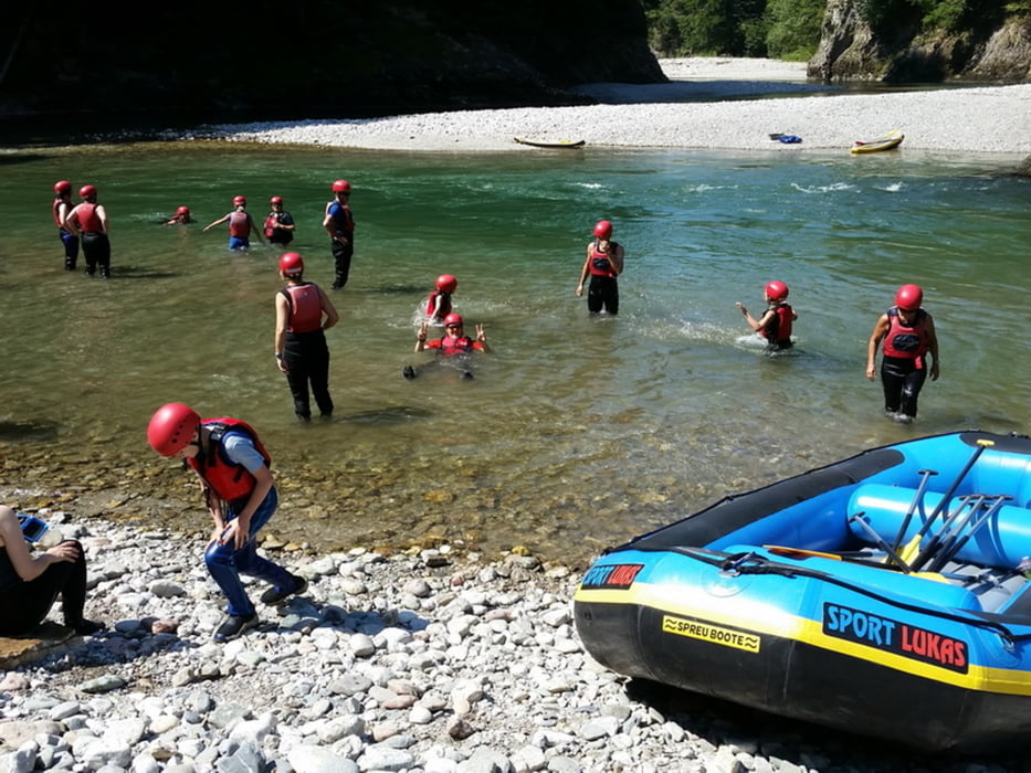
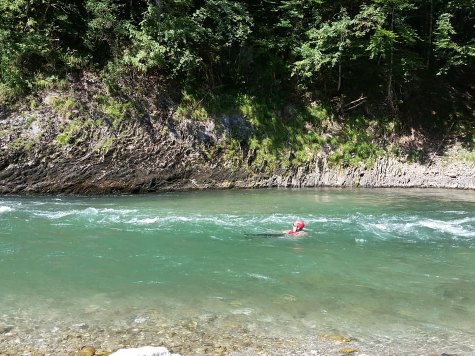
Bei Einstieg ist erstmal Pflichtbaden angesagt. Zum Glück hatten wir Neopren-Anzüge an.
Wassertemperatur 14 Grad
Lufttemperatur: 35 Grad (sonnig)
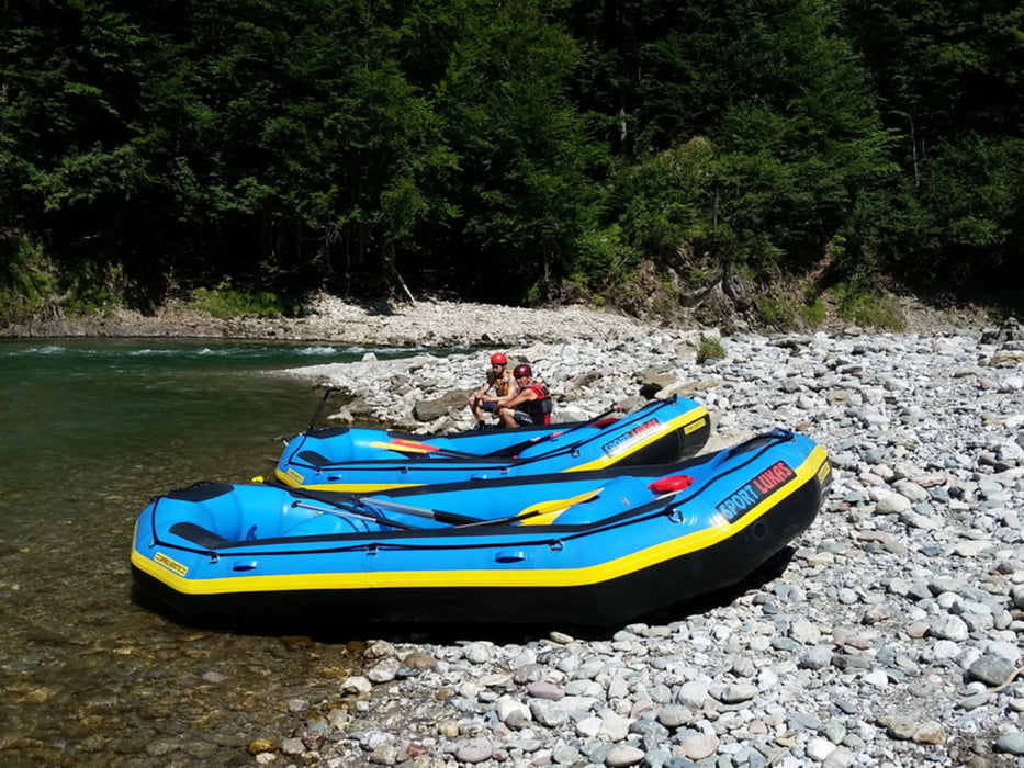
Bei uns sitzen 8 Leute im Boot. Steuerman ist David.
Die Rafting bzw. Wildwasserstrecken werden auf einer Skale von 1-6 eingeteilt. Die Tiroler Ache liegt auf der Skala bei 1-2 und aufgrund des Niedrigwasser eher bei 1.
Relativ entspannt geht es so zurück. Unterwegs bekommen wir viel von David erklärt. Immer mal Stopps mit Pausen zum Baden. Etwas spannend wird es in der Hasenklamm.

Nach gut 4h sind wir am Ausstieg bei den Autos.

Fazit:
- bei den Außentemperaturen war es ein wahrer Genuss
- empfehlenswert


Further information at

http://www.sportlukas.de/rafting/

Galeria trasy

Mapa trasy i profil wysokości

  • Open Street Map
  • Google
Minimum height 568 m Maximum height 609 m Widok szczegółowy

More about the tour author

Stummi
Member since 2009

Send private message

Komentarze

GPS tracks

Trackpoints
  • GPX / Garmin Map Source (gpx) download
  • TCX / Garmin Training Center® (tcx) download
  • CRS / Garmin Training Center® (crs) download
  • Google Earth (kml) download
  • G7ToWin (g7t) download
  • TTQV (trk) download
  • Overlay (ovl) download
  • Fugawi (txt) download
  • Kompass (DAV) Track (tk) download
  • Karta trasy (pdf) download
  • Original file of the author (gpx) download

More about the tour author

Stummi
Member since 2009

Send private message
Share track
Add to my favorites
Remove from my favorites
Edit tags
My score
Rate
Trasa: Rafting - Schleching - Trioler Ache
Rodzaj: Łodzi i kajaków
Długość: 4,9 km
Evaluated on:
Czas trwania:
Day(s)
Hour(s)
Minute(s)
Ocena: Krajobraz Czynnik zadowolenia Kondycja Technika