Login

Zapomniałeś swój login?

Cookies have to be accepted!
Your browser's cookie functionality is disabled. Please enable this functionality.

Not a member yet?

Register now
Login

Available for registred users only

Log in to use this feature.

Zapomniałeś swój login?

Cookies have to be accepted!
Your browser's cookie functionality is disabled. Please enable this functionality.

Not a member yet?

Register now
Filter
Kategorie
Advanced filters
  • Długość (km)
  • Wysokość
Zapisz filtr Reset filter

TrackRank

QRCode

Technical data

Długość5,2 km Wysokość10 m Way down10 m Czas trwania00:02 h:m Data25.12.2016
Oceny Author Krajobraz Czynnik zadowolenia Kondycja Technika

Statystyka

851 Widoki Oceny 20 Downloads / Pliki do pobrania Przeciętnie
Rate
  • Karta trasy
  • Dojazd
  • Downloads / Pliki do pobrania

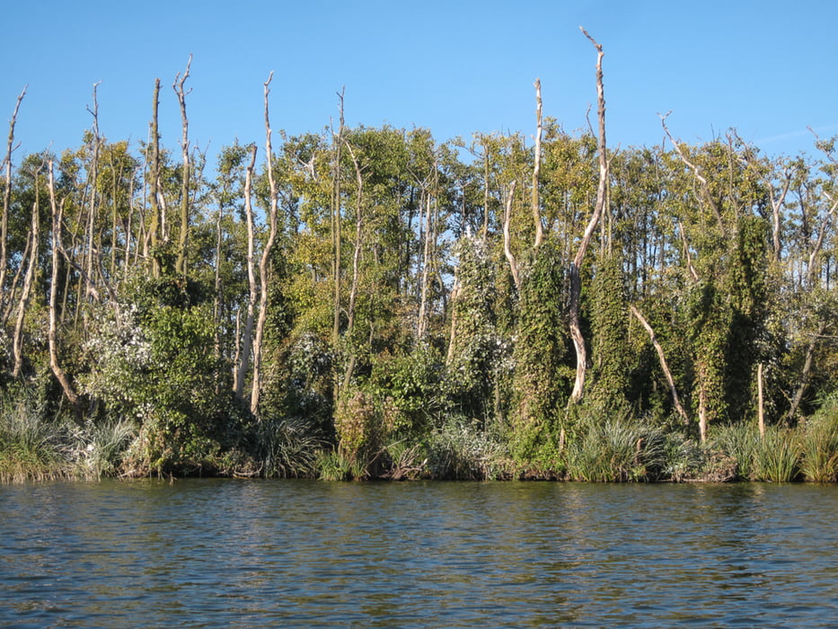
Natur pur und Tausende von Kormoranen, die in großen Kolonien rund um die Seen siedeln. Die kleine Beek im Ausfluss zum Achterwasser ist leider nicht mehr befahrbar. Zu DDR Zeiten wurde die Verbindung freigehalten, aber jetzt soll das Gebiet verwildern. So haben es uns die einzigen zwei Menschen erzählt, die wir hier getroffen haben: zwei Angler im Kahn.


Further information at

http://www.nandalee-camping.de

Galeria trasy

Mapa trasy i profil wysokości

  • Open Street Map
  • Google
Minimum height -9 m Maximum height 20 m Widok szczegółowy

More about the tour author

sugesei
Member since 2010

Send private message

Komentarze

Guter Einsatzpunkt am Campingplatz Nandalee. Da kann man hinterher noch ein wenig in sich gehen.

GPS tracks

Trackpoints
  • GPX / Garmin Map Source (gpx) download
  • TCX / Garmin Training Center® (tcx) download
  • CRS / Garmin Training Center® (crs) download
  • Google Earth (kml) download
  • G7ToWin (g7t) download
  • TTQV (trk) download
  • Overlay (ovl) download
  • Fugawi (txt) download
  • Kompass (DAV) Track (tk) download
  • Karta trasy (pdf) download
  • Original file of the author (gpx) download

More about the tour author

sugesei
Member since 2010

Send private message
Share track
Add to my favorites
Remove from my favorites
Edit tags
My score
Rate
Trasa: Schmollensee auf Usedom im Seekajak
Rodzaj: Łodzi i kajaków
Długość: 5,2 km
Evaluated on:
Czas trwania:
Day(s)
Hour(s)
Minute(s)
Ocena: Krajobraz Czynnik zadowolenia Kondycja Technika