
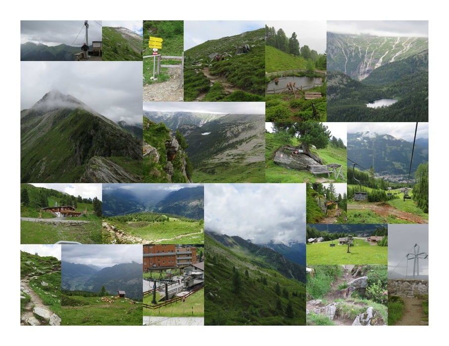

Ich fahre mit dem Graukogel Sessellift bis zur Bergstation.
Linkerhand beginnt der Steig auf den Graukogel. Ich folge dem Pfad stetig beran und bewundere die schöne Aussicht ins Gasteinertal.
Der kleine Gipfel auf der linken Seite ist der Hüttenkogel.
Ich steige zum Gipfelkreuz auf und bewundere die weite Sicht ins Land. Insbesondere zum Reedsee (ist vom Grünen Baum aus in etwa in 3 Stunden zu erreichen) und nach hinten ins Prossau-Tal mit seinen wunderbaren Bergbächen die steil ins Tal stürzen.
Plötzlich fallen Hagelkörner vom Himmel und ich beginne mit dem Abstieg zum Graukogel-Schutzhaus.
Der weitere Aufstieg zum Graukogel Gipfel bzw. Palfnersee fällt damit sprichwörtlich ins Wasser.
Further information at
https://www.gasteinertal.com/graukogelhuette/Mapa trasy i profil wysokości
Minimum height 1880 m
Maximum height 2217 m
More about the tour author
|
|
huberj59 |
Komentarze

Der große Parkplatz des Graukogel Sesselliftes befindet sich an den Koordinaten: N47° 06' 59.0" E13° 08' 28.1".
Von hier aus beginnt auch der Steig auf den Graukogel.
GPS tracks
Trackpoints-
GPX / Garmin Map Source (gpx) download
-
TCX / Garmin Training Center® (tcx) download
-
CRS / Garmin Training Center® (crs) download
-
Google Earth (kml) download
-
G7ToWin (g7t) download
-
TTQV (trk) download
-
Overlay (ovl) download
-
Fugawi (txt) download
-
Kompass (DAV) Track (tk) download
-
Karta trasy (pdf) download
-
Original file of the author (gpx) download
More about the tour author
|
|
huberj59 |
Add to my favorites
Remove from my favorites
Edit tags
Open track
My score
Rate