


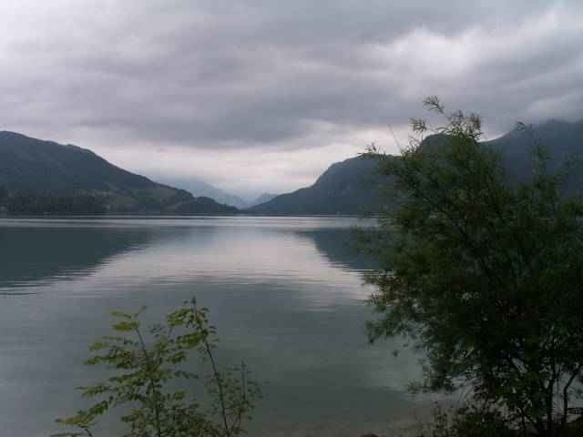
Das ist die Aufzeichnung der B-Strecke des Mondseer 5-Seen-Marathons. Die Strecke war mit 145km/900Hm ausgeschrieben. Es ist eine landschaftlich wunderschöne Tour, wenn man nicht gerade im Regen fährt... Natürlich gibt es auch einigen Verkehr, aber es dürfte auch unter normalen Bedingungen nicht so arg sein.
Die Route führt von Mondsee nach St. Gilgen (schöner Anstieg zum Warmwerden, ca.7%), Bad Ischl, Ebensee, Altmünster. Jetzt in zwei Auffahrten (max.12%) hinüber nach Steinbach/Attersee, N-Umrundung des Sees bis Nußdorf und über eine kräftige Steigung (15%?) zurück nach Mondsee.
Beim Marathon ging es in Bad ischl durch den Autotunnel - der ist für Fahrräder normalerweise verboten!
(Kennwort: hpv.org)
Further information at
http://www.naturfreunde-mondsee.at/index2.php?page=marathon_startseiteGaleria trasy
Mapa trasy i profil wysokości
Minimum height 426 m
Maximum height 822 m
More about the tour author
|
|
toxy |
Komentarze

Mondsee ist öffentlich nur per Bus erreichbar, 30km von Salzburg.
Mit dem Auto: A1, Ausfahrt Mondsee
Mit dem Auto: A1, Ausfahrt Mondsee
GPS tracks
Trackpoints-
GPX / Garmin Map Source (gpx) download
-
TCX / Garmin Training Center® (tcx) download
-
CRS / Garmin Training Center® (crs) download
-
Google Earth (kml) download
-
G7ToWin (g7t) download
-
TTQV (trk) download
-
Overlay (ovl) download
-
Fugawi (txt) download
-
Kompass (DAV) Track (tk) download
-
Karta trasy (pdf) download
-
Original file of the author (g7t) download
More about the tour author
|
|
toxy |
Add to my favorites
Remove from my favorites
Edit tags
Open track
My score
Rate