
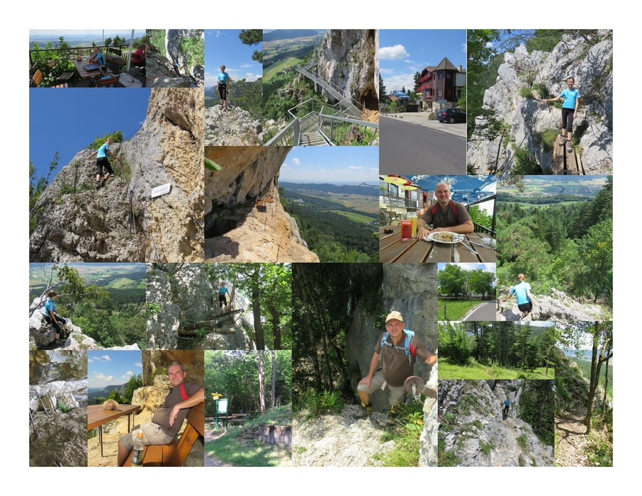

Einige Meter vor dem Kohlröserlhaus, in etwa Wandeckstraße 112, beginnt der Leiterlsteig, gut beschildert, an der rechten Straßensteite.
Zuerst geht es über einen schönen Waldweg bergab. Dann stößt man auf eine Forststraße und folgt dieser weiter Richtung Tal.
Fast schon unten gibt es die einzige Stelle mit Sicherung und Stahlsprossen. Dort geht es ein kleines Stück hinunter bis an den Fuß der Wand.
Further information at
http://www.hohewand.at/Mapa trasy i profil wysokości
Minimum height 627 m
Maximum height 847 m
More about the tour author
|
|
huberj59 |
Komentarze

Start der Wanderung ist der Parkplatz an den Koordinaten: N47 50 13.2 E16 04 31.4 in Stollhof.
Stollhof erreicht man über die L4073.
Anmerkung: Dies ist nicht der näheste Parkplatz für den Leiterlsteig. Ich habe diese gewählt, da er für meine Tourenplanung optimal war.
GPS tracks
Trackpoints-
GPX / Garmin Map Source (gpx) download
-
TCX / Garmin Training Center® (tcx) download
-
CRS / Garmin Training Center® (crs) download
-
Google Earth (kml) download
-
G7ToWin (g7t) download
-
TTQV (trk) download
-
Overlay (ovl) download
-
Fugawi (txt) download
-
Kompass (DAV) Track (tk) download
-
Karta trasy (pdf) download
-
Original file of the author (gpx) download
More about the tour author
|
|
huberj59 |
Add to my favorites
Remove from my favorites
Edit tags
Open track
My score
Rate