
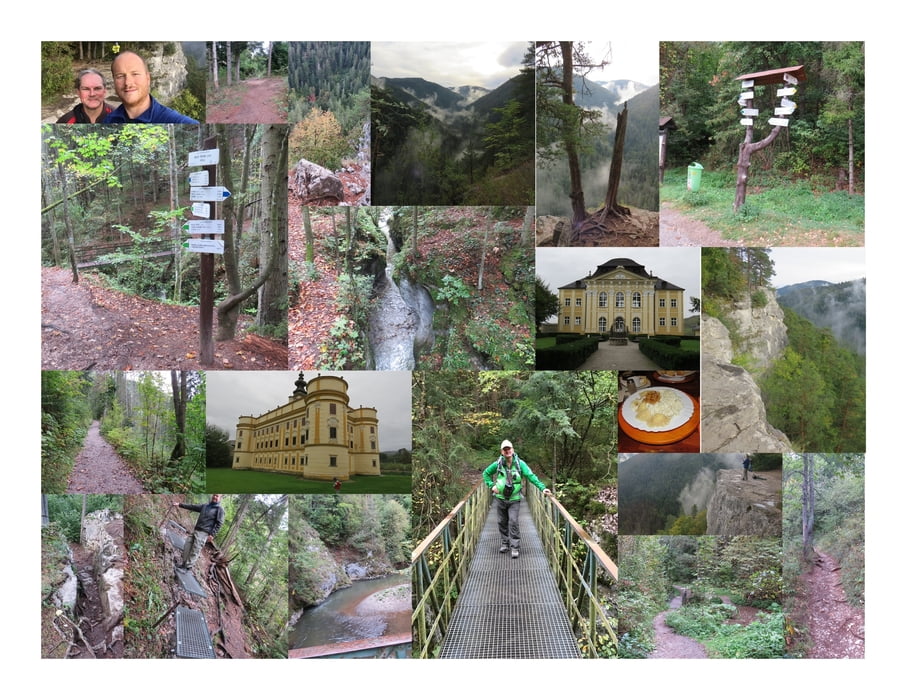

Wir beginnen unsere kleine Runde vom Parkplatz in Cingov aus und folgen der Hornad flussaufwärts.
Bei der Biely Potok überqueren wir eine schmale Brücke und beginnen den steilen und anstrengenden Aufstieg zum Aussichtspunkt "Tomasovsky Vyhlad".
Von der beeindruckenden Steilwand ergeben sich wunderbare Fotomotive hinab ins Tal und über das Paradise.
Nun folgen wir dem Wanderweg wieder bergab, durchqueren das alte Jugendlager und kommen wieder zurück zu unserem Startpunkt.
Further information at
http://penzionthamasy.sk/Mapa trasy i profil wysokości
Minimum height 492 m
Maximum height 659 m
More about the tour author
|
|
huberj59 |
Komentarze

Der gratis Parkplatz liegt an den Koordinaten N48° 56' 42.5" E20° 29' 06.7" in Cingov.
GPS tracks
Trackpoints-
GPX / Garmin Map Source (gpx) download
-
TCX / Garmin Training Center® (tcx) download
-
CRS / Garmin Training Center® (crs) download
-
Google Earth (kml) download
-
G7ToWin (g7t) download
-
TTQV (trk) download
-
Overlay (ovl) download
-
Fugawi (txt) download
-
Kompass (DAV) Track (tk) download
-
Karta trasy (pdf) download
-
Original file of the author (gpx) download
More about the tour author
|
|
huberj59 |
Add to my favorites
Remove from my favorites
Edit tags
Open track
My score
Rate