Login

Zapomniałeś swój login?

Cookies have to be accepted!
Your browser's cookie functionality is disabled. Please enable this functionality.

Not a member yet?

Register now
Login

Available for registred users only

Log in to use this feature.

Zapomniałeś swój login?

Cookies have to be accepted!
Your browser's cookie functionality is disabled. Please enable this functionality.

Not a member yet?

Register now
Filter
Kategorie
Advanced filters
  • Długość (km)
  • Wysokość
Zapisz filtr Reset filter

TrackRank

QRCode

Technical data

Długość0,3 km Wysokość0 m Way down102 m Czas trwania00:16 h:m Data16.06.2021
Oceny Author Krajobraz Czynnik zadowolenia Kondycja Technika

Statystyka

339 Widoki Oceny 5 Downloads / Pliki do pobrania Przeciętnie
Rate
  • Karta trasy
  • Dojazd
  • Downloads / Pliki do pobrania

Zischka Steig (1-)

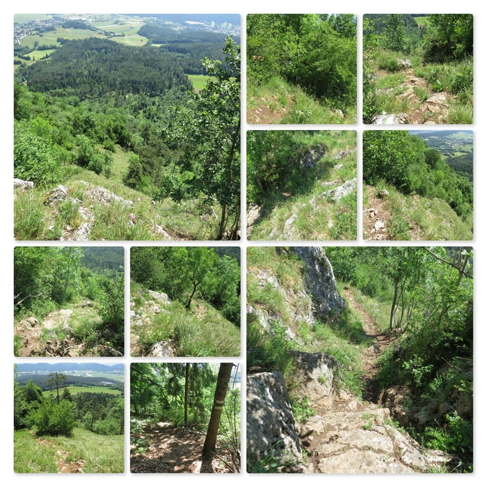
Links vom Gipfelkreuz (gut markiert mit einer Tafel) beginnt der Zischkasteig. Der Steig windet sich den Felsen steil nach unten und es gibt einige wenige Stellen wo ich klettern muss. Bald komme ich in den Wald und auf eine Forststraße.

Further information at

http://www.volki.at/berge/hw/hw.shtml

Mapa trasy i profil wysokości

  • Open Street Map
  • Google
Minimum height 673 m Maximum height 819 m Widok szczegółowy

More about the tour author

huberj59
Member since 2009

Send private message

Komentarze

Parkplatz am Sportplatz in Dreistätten, an den Koordinaten: N47° 51' 18.1" E16° 05' 58.6"

GPS tracks

Trackpoints
  • GPX / Garmin Map Source (gpx) download
  • TCX / Garmin Training Center® (tcx) download
  • CRS / Garmin Training Center® (crs) download
  • Google Earth (kml) download
  • G7ToWin (g7t) download
  • TTQV (trk) download
  • Overlay (ovl) download
  • Fugawi (txt) download
  • Kompass (DAV) Track (tk) download
  • Karta trasy (pdf) download
  • Original file of the author (gpx) download

More about the tour author

huberj59
Member since 2009

Send private message
Share track
Add to my favorites
Remove from my favorites
Edit tags
My score
Rate
Trasa: Dreistätten - Hohe Wand - Zischkasteig
Rodzaj: Wędrówki
Długość: 0,3 km
Evaluated on:
Czas trwania:
Day(s)
Hour(s)
Minute(s)
Ocena: Krajobraz Czynnik zadowolenia Kondycja Technika