
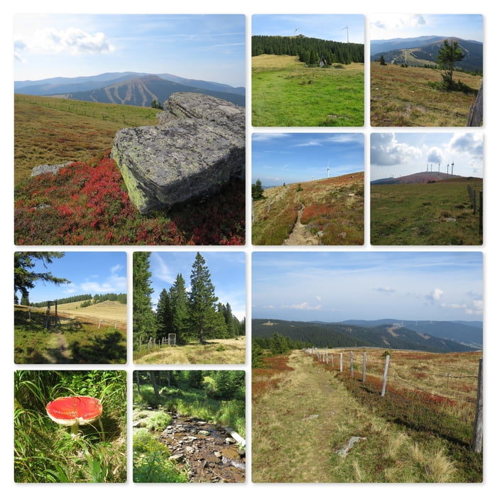

Die Wanderung beginnt am großen Parkplatz auf der Koralpe. Ich nehme de Wanderweg, vorbei an der großen Kapelle, hinauf zu den Windrädern.
Oben angekommen halte ich mich links und folge dem sehr gut markierten Wanderweg bergab am Windpark entlang.
Ich bewundere die unendlichen Felder von Heidelbeeren und Ribisel.
An der Abzweigung zum Bärofen biege ich links ab. Es folgt ein kurzer Anstieg auf eine sehr große Kuhweide. Ich umrunde die Kuhherde und folge einem Forstweg bis zum Wegkreuz (auf den Bärofen hinauf).
Ich gehe jedoch gerade weiter und folge der Forststraße bergab. Der Wanderweg führt in Folge durch den Wald hinunter bis zu unserer Ferien Hütte.
Further information at
https://www.mondial-reisen.com/de/huts/bof-ktn-skiregion-sued-huette-hut-7-pers?Mapa trasy i profil wysokości
Minimum height 1324 m
Maximum height 1817 m
Komentarze

Startpunkt der Wanderung ist der Parkplatz an den Koordinaten N46° 50' 17.9" E15° 01' 01.6".
GPS tracks
Trackpoints-
GPX / Garmin Map Source (gpx) download
-
TCX / Garmin Training Center® (tcx) download
-
CRS / Garmin Training Center® (crs) download
-
Google Earth (kml) download
-
G7ToWin (g7t) download
-
TTQV (trk) download
-
Overlay (ovl) download
-
Fugawi (txt) download
-
Kompass (DAV) Track (tk) download
-
Karta trasy (pdf) download
-
Original file of the author (gpx) download
Add to my favorites
Remove from my favorites
Edit tags
Open track
My score
Rate