


Rif. Don Barbera-Demonte
Rif. Don Barbera-Passo del Duca-Rif. Pian delle Gorre-
Villagio Ardua-San Bartolomeo-Vigna-Pradeboni-Boves-
Roccavione-Bandito-Valdieri-Madonna del Colletto-Demonte
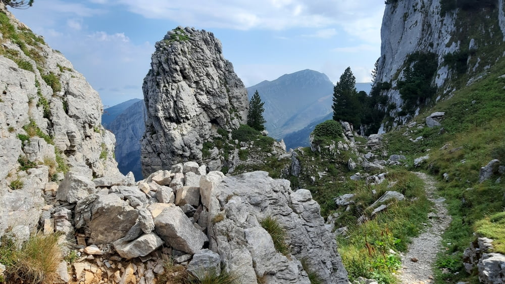
Etappe ist fahrend entstanden. Da mir der Passo Sabbione inkl Schlechtwetterankündigung nicht geheuer war, hab ich kurzerhand auf den Passo del Duca umgelenkt. Sehr gute Wahl! Im Vergleich zu vor 5 Jahren, da kam ich von der anderen Seite, ist der Weg deutlich verbessert und ich glaube, damals war es auch noch keine off. MTB Strecke.
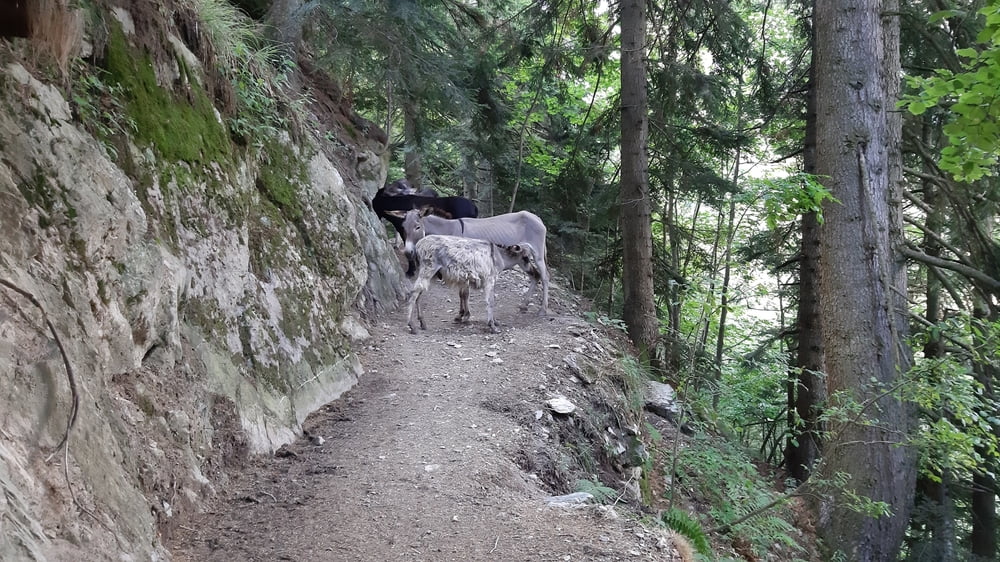
So war der Großteil gut fahrbar. Toll! Einige sehr nette Begegnuingen mit Wanderern. Ab Villaggio Ardua begann dann ein bissl die Sucherei Rg. Valdieri. Es sind hauptsächlich Nebenstraßen (kaum Verkehr), ein paar Schotterabschnitte, bissl Wanderwege.Nicht so übel.
Von Valdieri bin ich wieder zur Madonna del Colletto hinauf. Das Gewitter ließ zum Glück noch auf sich warten. Bis Demonte dann auf der Straße.
Quartier Albergo Moderno, NF 60€, Abendessen im Haus, ok.
Galeria trasy
Mapa trasy i profil wysokości
Minimum height 600 m
Maximum height 2218 m
More about the tour author
|
|
mitter |
Komentarze

Start beim Rifugio Don Barbera.
GPS tracks
Trackpoints-
GPX / Garmin Map Source (gpx) download
-
TCX / Garmin Training Center® (tcx) download
-
CRS / Garmin Training Center® (crs) download
-
Google Earth (kml) download
-
G7ToWin (g7t) download
-
TTQV (trk) download
-
Overlay (ovl) download
-
Fugawi (txt) download
-
Kompass (DAV) Track (tk) download
-
Karta trasy (pdf) download
-
Original file of the author (gpx) download
More about the tour author
|
|
mitter |
Add to my favorites
Remove from my favorites
Edit tags
Open track
My score
Rate