
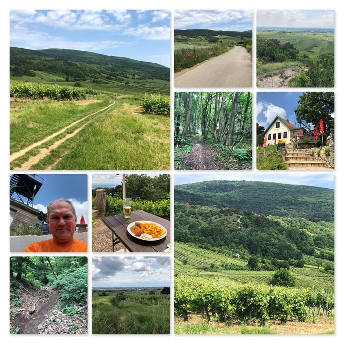

Meine Wanderung startet am Parkplatz bei der Reb Lounge. Link: Reblounge » Heurigendorf Pfaffstätten
Ich folge dem asphaltierten Weg Richtung Sattelriegel und umrunde den Hügel.
Dann steige ich auf den Heferlberg auf und wandere zur Veigl-Hütte. Die Hütte hat leider geschlossen. Hinweise siehe: Veigl-Hütte – Die gmiatliche Hüttn in den Gumpoldskirchner Weingärten (veigl-huette.at) oder (20+) Gumpoldskirchner Veigl-Hütte | Facebook.
Dann geht es über den Tännspitz zur Rudolf-Proksch-Hütte. Dort mach ich Rast und genieße die Sonne bei einem Bier und einer Curry-Wurst.
Dann nehme ich den direkten Weg nach Pfaffstätten hinunter, wieder zurück zu meinem Auto.
Further information at
https://www.prokschhuette.com/Mapa trasy i profil wysokości
Minimum height 228 m
Maximum height 570 m
More about the tour author
|
|
huberj59 |
Komentarze

Parkplatz beim Wustinger, Reblounge an den Koordinaten N48° 01' 17.9" E16° 15' 25.9".
GPS tracks
Trackpoints-
GPX / Garmin Map Source (gpx) download
-
TCX / Garmin Training Center® (tcx) download
-
CRS / Garmin Training Center® (crs) download
-
Google Earth (kml) download
-
G7ToWin (g7t) download
-
TTQV (trk) download
-
Overlay (ovl) download
-
Fugawi (txt) download
-
Kompass (DAV) Track (tk) download
-
Karta trasy (pdf) download
-
Original file of the author (gpx) download
More about the tour author
|
|
huberj59 |
Add to my favorites
Remove from my favorites
Edit tags
Open track
My score
Rate