Login

Zapomniałeś swój login?

Cookies have to be accepted!
Your browser's cookie functionality is disabled. Please enable this functionality.

Not a member yet?

Register now
Login

Available for registred users only

Log in to use this feature.

Zapomniałeś swój login?

Cookies have to be accepted!
Your browser's cookie functionality is disabled. Please enable this functionality.

Not a member yet?

Register now
Filter
Kategorie
Advanced filters
  • Długość (km)
  • Wysokość
Zapisz filtr Reset filter

TrackRank

QRCode

Technical data

Długość51,0 km Wysokość2353 m Way down2357 m Czas trwania03:45 h:m Data18.11.2023
Oceny Author Krajobraz Czynnik zadowolenia Kondycja Technika

Statystyka

166 Widoki Oceny 19 Downloads / Pliki do pobrania Przeciętnie
Rate
  • Karta trasy
  • Dojazd
  • Downloads / Pliki do pobrania
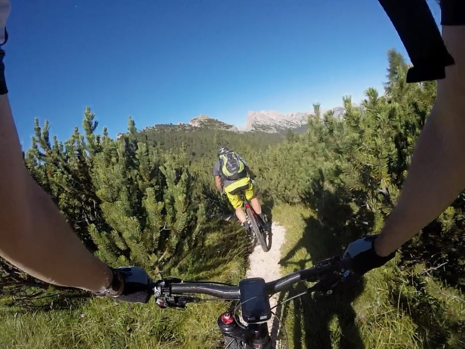
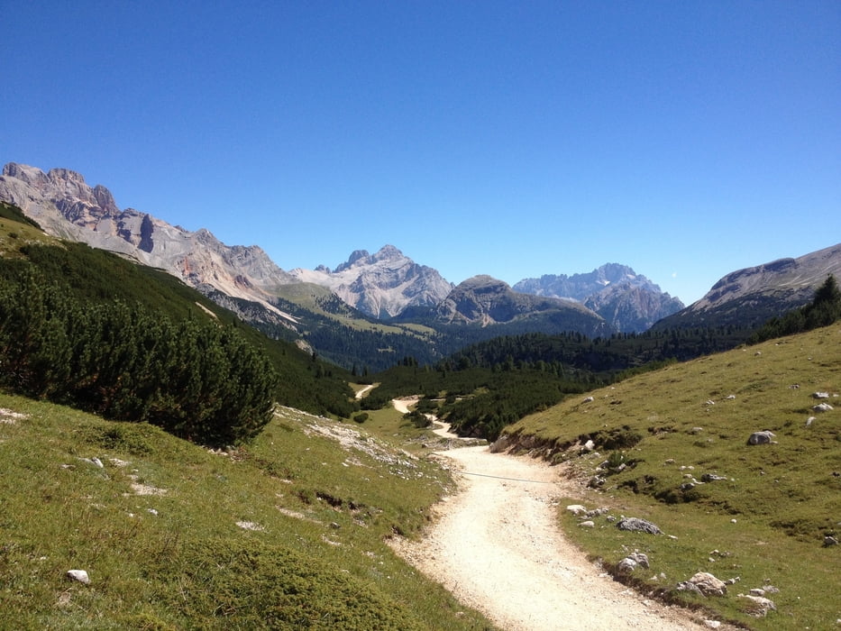
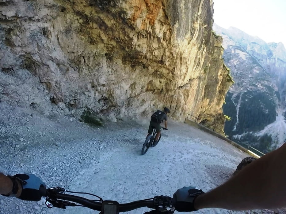
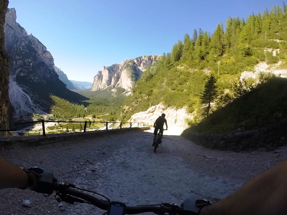
Diese Genießer-Tour für alle Dolomiten-Liebhaber ist im Traumtouren TransaAlp Buch von Ulrich Stanciu beschrieben (Tour 18: Details siehe dort) und ist absolut empfehlenswert. Sehr Trail lastig geht es in vier Tage durch die verschiedenen Landschaften der Dolomiten. Wir wählten die Seilbahn/Sessellift Variante – so kamen wir am Tag auf durchschnittlich 1000hm zum Kurbeln und konnten die Trails so richtig genießen. Den Gepäcktransport organisierten wir uns wieder mit einem lokalen Taxi Unternehmen. Einzig in LaVilla war es schwierig im August ein Quartier für eine Nacht zu finden.

Galeria trasy

Mapa trasy i profil wysokości

  • Open Street Map
  • Google
Minimum height 1239 m Maximum height 2185 m Widok szczegółowy

More about the tour author

ETTMAYER
Member since 2007

Send private message

Komentarze

GPS tracks

Trackpoints
  • GPX / Garmin Map Source (gpx) download
  • TCX / Garmin Training Center® (tcx) download
  • CRS / Garmin Training Center® (crs) download
  • Google Earth (kml) download
  • G7ToWin (g7t) download
  • TTQV (trk) download
  • Overlay (ovl) download
  • Fugawi (txt) download
  • Kompass (DAV) Track (tk) download
  • Karta trasy (pdf) download
  • Original file of the author (gpx) download

More about the tour author

ETTMAYER
Member since 2007

Send private message
Share track
Add to my favorites
Remove from my favorites
Edit tags
My score
Rate
Trasa: Giro delle Dolomiti, Etappe 4: Cortina d’Ampezzo - St.Vigil
Rodzaj: Rower górski (MTB)
Długość: 51,0 km
Evaluated on:
Czas trwania:
Day(s)
Hour(s)
Minute(s)
Ocena: Krajobraz Czynnik zadowolenia Kondycja Technika