Login

Zapomniałeś swój login?

Cookies have to be accepted!
Your browser's cookie functionality is disabled. Please enable this functionality.

Not a member yet?

Register now
Login

Available for registred users only

Log in to use this feature.

Zapomniałeś swój login?

Cookies have to be accepted!
Your browser's cookie functionality is disabled. Please enable this functionality.

Not a member yet?

Register now
Filter
Kategorie
Advanced filters
  • Długość (km)
  • Wysokość
Zapisz filtr Reset filter

TrackRank

QRCode

Technical data

Długość12,1 km Wysokość873 m Way down904 m Czas trwania03:30 h:m Data31.12.2023
Oceny Author Krajobraz Czynnik zadowolenia Kondycja Technika

Statystyka

412 Widoki Oceny 0 Downloads / Pliki do pobrania Przeciętnie
Rate
  • Karta trasy
  • Dojazd
  • Downloads / Pliki do pobrania
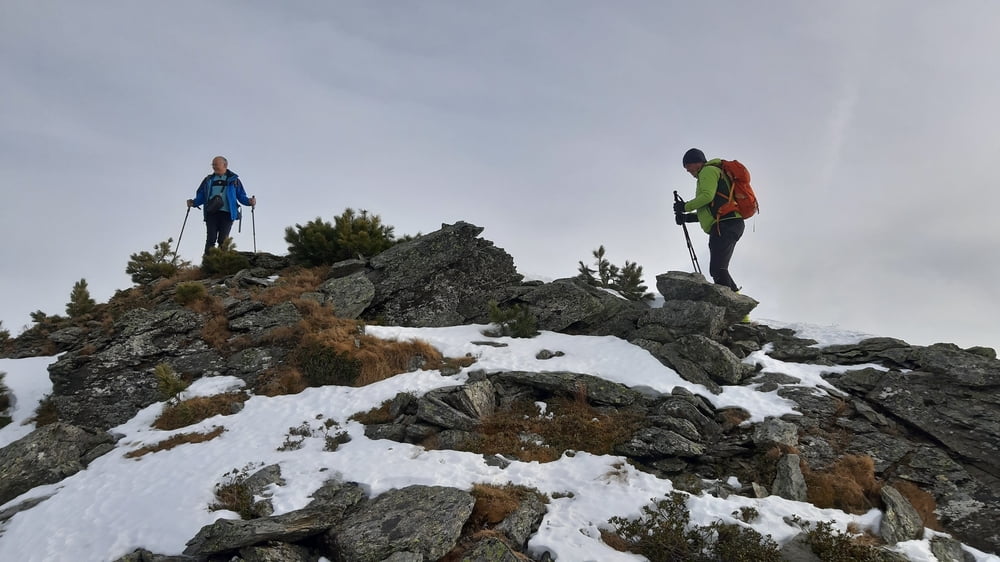
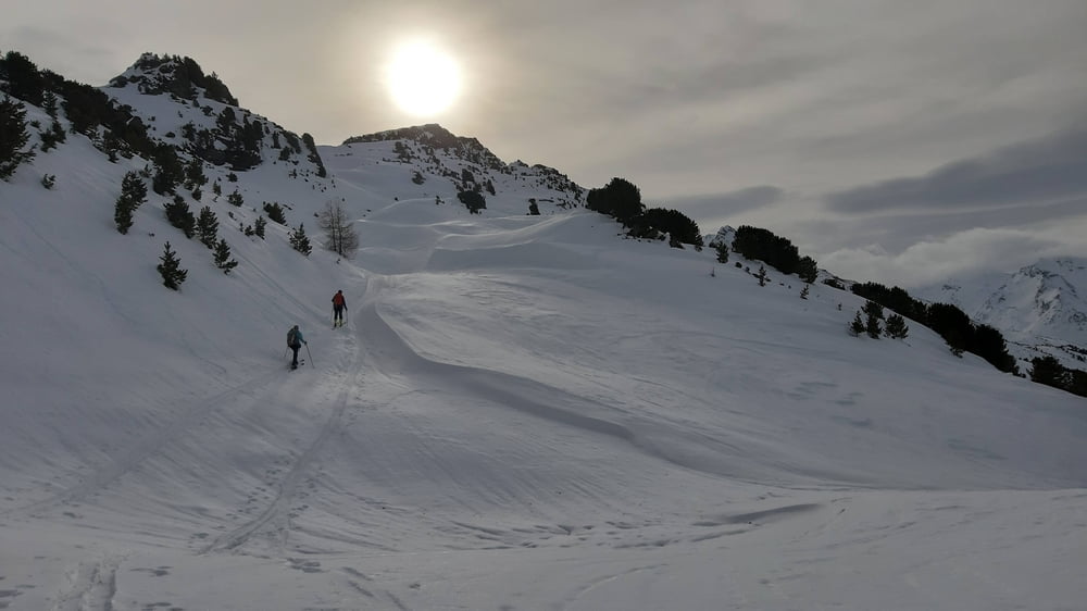
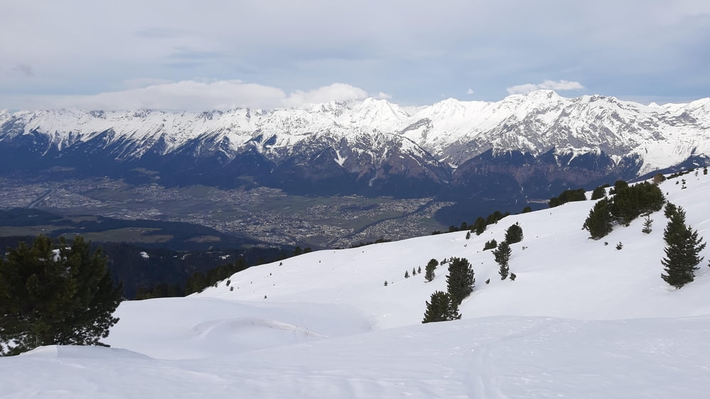
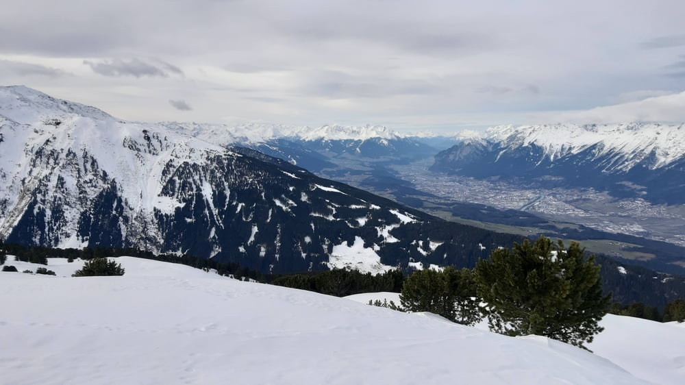
Bis knapp unterhalb der Largozalm auf einer Forststraße unterwegs, dann ab ins freie Gelände. Unser Ziel befindet sich zwischen dem Largoz und der Wattenspitze. Herrlicher Weitblick ins Inntal und die gewaltige Bergwelt, die es umschließt. Hinunter sind wir im Großen und Ganzen der Aufstiegsspur gefolgt,

Galeria trasy

Mapa trasy i profil wysokości

  • Open Street Map
  • Google
Minimum height 1383 m Maximum height 2311 m Widok szczegółowy

More about the tour author

mitter
Member since 2008

Send private message

Komentarze

Von Volders der Bergstraße rauf bis zur Krepperhütte. Gleich danach links rauf gibt es einen gebührenfreien Parkplatz.

GPS tracks

Trackpoints
  • GPX / Garmin Map Source (gpx) download
  • TCX / Garmin Training Center® (tcx) download
  • CRS / Garmin Training Center® (crs) download
  • Google Earth (kml) download
  • G7ToWin (g7t) download
  • TTQV (trk) download
  • Overlay (ovl) download
  • Fugawi (txt) download
  • Kompass (DAV) Track (tk) download
  • Karta trasy (pdf) download
  • Original file of the author (gpx) download

More about the tour author

mitter
Member since 2008

Send private message
Share track
Add to my favorites
Remove from my favorites
Edit tags
My score
Rate
Trasa: beim Largoz 231231
Rodzaj: Narty
Długość: 12,1 km
Evaluated on:
Czas trwania:
Day(s)
Hour(s)
Minute(s)
Ocena: Krajobraz Czynnik zadowolenia Kondycja Technika