Login

Zapomniałeś swój login?

Cookies have to be accepted!
Your browser's cookie functionality is disabled. Please enable this functionality.

Not a member yet?

Register now
Login

Available for registred users only

Log in to use this feature.

Zapomniałeś swój login?

Cookies have to be accepted!
Your browser's cookie functionality is disabled. Please enable this functionality.

Not a member yet?

Register now
Filter
Kategorie
Advanced filters
  • Długość (km)
  • Wysokość
Zapisz filtr Reset filter

TrackRank

QRCode

Technical data

Długość10,0 km Wysokość955 m Way down896 m Czas trwania04:30 h:m Data03.01.2024
Oceny Author Krajobraz Czynnik zadowolenia Kondycja Technika

Statystyka

366 Widoki Oceny 0 Downloads / Pliki do pobrania Przeciętnie
Rate
  • Karta trasy
  • Dojazd
  • Downloads / Pliki do pobrania
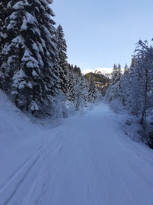
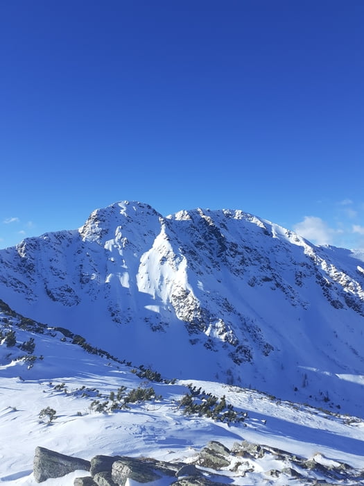
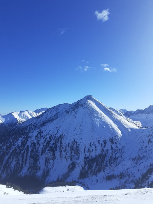
Vom ehem. GH Braun über die Wiese zur Kälberhütte und weiter ins obere Braunkar. Am Gipfelhang bis zum schmucklosen, aber aussichtsreichen Triebenkogel. Für den Aufstieg sind meist Spuren vorhanden. Verschiedene Möglichkeiten. Abstieg annähernd am Anstiegsweg.

Galeria trasy

Mapa trasy i profil wysokości

  • Open Street Map
  • Google
Minimum height 1154 m Maximum height 2083 m Widok szczegółowy

More about the tour author

JoHangler
Member since 2013

Send private message

Komentarze

Auf der A9 Pyhrnautobahn bis zur Abfahrt Trieben. Richtung Hohentauern bis zum GH Brodjäger. Unmittelbar danach links ins Triebental bis zum Parkplatz bei ehemaligen Gasthof Braun.

GPS tracks

Trackpoints
  • GPX / Garmin Map Source (gpx) download
  • TCX / Garmin Training Center® (tcx) download
  • CRS / Garmin Training Center® (crs) download
  • Google Earth (kml) download
  • G7ToWin (g7t) download
  • TTQV (trk) download
  • Overlay (ovl) download
  • Fugawi (txt) download
  • Kompass (DAV) Track (tk) download
  • Karta trasy (pdf) download
  • Original file of the author (gpx) download

More about the tour author

JoHangler
Member since 2013

Send private message
Share track
Add to my favorites
Remove from my favorites
Edit tags
My score
Rate
Trasa: Triebenkogel 2055m
Rodzaj: Rakiety śnieżne
Długość: 10,0 km
Evaluated on:
Czas trwania:
Day(s)
Hour(s)
Minute(s)
Ocena: Krajobraz Czynnik zadowolenia Kondycja Technika