


Schöne Wanderung mit herrlichen Ausblicken!
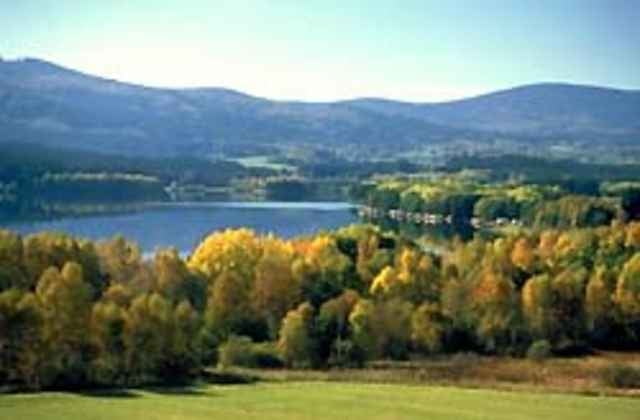
Am Moldaublick stehen und den Blick über das südböhmische Meer (Moldaustausee) schweifen lassen, dass ist wohl der Höhepunkt dieser Wanderung!
Ausgangspunkt dieser Wanderung ist beim Jugendgästehaus in Ulrichsberg.
Weg Nr. 1
Fordern Sie unsere Wanderkarte um EUR 3,00 hier an: info@boehmerwald.at!
Oder rufen Sie uns einfach an: Infotelefon +43 5 7890 100!
Further information at
http://www.boehmerwald.atGaleria trasy
Mapa trasy i profil wysokości
Minimum height 534 m
Maximum height 1020 m
More about the tour author
|
|
aigen-schlaegl |
Komentarze

Auto: Westautobahn - Linz - B 127 - Rohrbach / Aigen-Schlägl, dann Dreisesselberg Landesstraße bis Ulrichsberg
Über München - Landshut - A92 - Deggendorf - Passau A3 - Abfahrt Nord über Wegscheid /
Über Nürnberg - Regensburg A3 - Passau - Abfahrt Nord über Wegscheid /
Bahn: Über Linz mit Mühlkreisbahn, dann Bus bis Ulrichsberg
Bus: Ab Linz mit BB 2143 oder 2266, http://www.oebb.at
GPS tracks
Trackpoints-
GPX / Garmin Map Source (gpx) download
-
TCX / Garmin Training Center® (tcx) download
-
CRS / Garmin Training Center® (crs) download
-
Google Earth (kml) download
-
G7ToWin (g7t) download
-
TTQV (trk) download
-
Overlay (ovl) download
-
Fugawi (txt) download
-
Kompass (DAV) Track (tk) download
-
Karta trasy (pdf) download
-
Original file of the author (g7t) download
More about the tour author
|
|
aigen-schlaegl |
Add to my favorites
Remove from my favorites
Edit tags
Open track
My score
Rate