Login

Si pozabil/a podatke za prijavo?

Cookies have to be accepted!
Your browser's cookie functionality is disabled. Please enable this functionality.

Not a member yet?

Register now
Login

Available for registred users only

Log in to use this feature.

Si pozabil/a podatke za prijavo?

Cookies have to be accepted!
Your browser's cookie functionality is disabled. Please enable this functionality.

Not a member yet?

Register now
Filter
Kategorije
Advanced filters
  • Dolžina (km)
  • Metri nadmorske višine
Shrani filter Reset filter

TrackRank

QRCode

Technical data

Dolžina30,8 km Metri nadmorske višine651 m Way down657 m Trajanje00:00 h:m Datum07.07.2014
Ocene Author Pokrajina Dejavnik zabave Kondicija Tehnika

Statistika

422 Pogledi Ocene 52 Prenosi Povprečje
Rate
  • List z izleti
  • Prihod
  • Prenosi

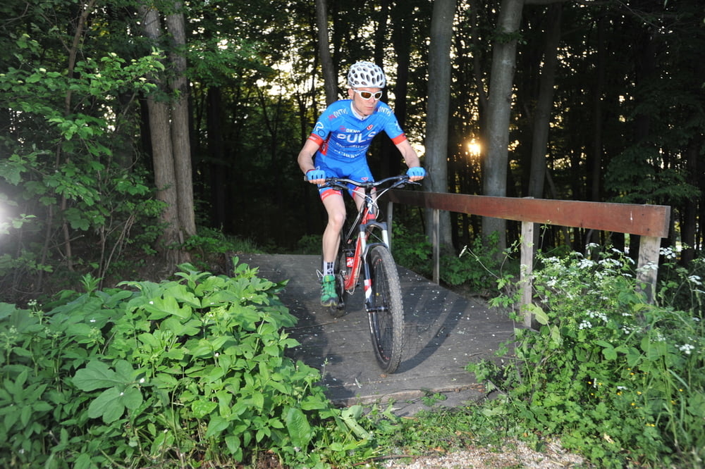
U svega tridesetak kilometara na ovoj ruti napravit ćete 800
metara visinske razlike a stalna izmjena tempa, uzbrdica
i nizbrdica, asfalta, makadama i šumskih puteva čine je
izuzetno zanimljivom i uzbudljivom stazom. Na ruti ćete
proći pored nekoliko zanimljivih točaka koje svakako vrijedi
posjetiti a sa vidikovca seže pogled na dolinu Mure, Sveti
Urban i obližnju Sloveniju.

In only 30 kilometers of this trail we cover 800 meters of altitude difference and experience constant changes of pace. Uphill and downhill rides, asphalt, gravel and forest roads make it a very interesting and exciting trail. On this trail you will come by a few interesting points worth visiting and a belvedere overlooking the valley of the river Mura, St. Urban and neighboring Slovenia.


http://spa-sport.hr
http://www.adriabike.hr

Galerija izletov

Zemljevid in višinski profil izleta

  • Open Street Map
  • Google
Minimum height 186 m Maximum height 323 m Prikaz podrobnosti

More about the tour author

AdriaBikeHotels
Member since 2014

Send private message

Komentarji

Poti GPS

Trackpoints
  • GPX / Garmin Map Source (gpx) download
  • TCX / Garmin Training Center® (tcx) download
  • CRS / Garmin Training Center® (crs) download
  • Google Earth (kml) download
  • G7ToWin (g7t) download
  • TTQV (trk) download
  • Overlay (ovl) download
  • Fugawi (txt) download
  • Kompass (DAV) Track (tk) download
  • List z izleti (pdf) download
  • Original file of the author (gpx) download

More about the tour author

AdriaBikeHotels
Member since 2014

Send private message
Share track
Add to my favorites
Remove from my favorites
Edit tags
My score
Rate
Izlet: Sv. Martin na Muri. MTB Staza br. 2.
Vrsta: Gorsko kolo
Dolžina: 30,8 km
Evaluated on:
Trajanje:
Day(s)
Hour(s)
Minute(s)
Ocena: Pokrajina Dejavnik zabave Kondicija Tehnika