


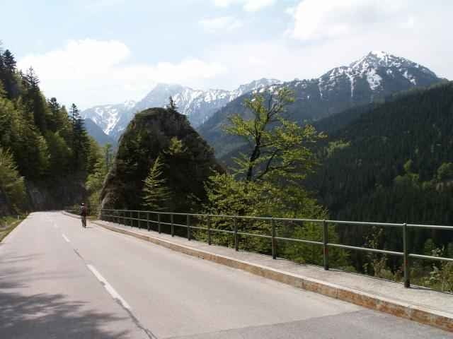
Start kann wieder Micheldorf oder Kirchdorf/Krems sein. Auf der B138 in Richtung Windischgarsten. Die "Waldner Höhe" bringt die erste Herausforderung zum Eingewöhnen. Nach Windischgarsten geht es dann los - hinauf auf den Hengstpass (987m). Eine Abfahrt durch schattige, wildromantische Schluchten, dann in Altenmarkt auf die Bundesstraße Richtung Steyr. Durch Großraming nach Ternberg, wo der nächste Anstieg wartet - in praller Sonne geht es hinauf zur "Sandner Linde". Rasant hinunter nach Grünburg und am jetzt komplett asphaltierten SteyrtalRadweg ausrollen bis Micheldorf.
Einziger Nachteil der Strecke: Auch Motorradfahrer lieben den Hengstpass!
(Kennwort: hpv.org)
Einziger Nachteil der Strecke: Auch Motorradfahrer lieben den Hengstpass!
(Kennwort: hpv.org)
Galerija izletov
Zemljevid in višinski profil izleta
Minimum height 343 m
Maximum height 988 m
More about the tour author
|
|
toxy |
Komentarji

Bahn: Kirchdorf/Krems (IC) (Pyhrnbahn Linz-Graz)
Auto: A9
- von N Ausfahrt Inzersdorf
- von S Ausfahrt Klaus
Auto: A9
- von N Ausfahrt Inzersdorf
- von S Ausfahrt Klaus
Poti GPS
Trackpoints-
GPX / Garmin Map Source (gpx) download
-
TCX / Garmin Training Center® (tcx) download
-
CRS / Garmin Training Center® (crs) download
-
Google Earth (kml) download
-
G7ToWin (g7t) download
-
TTQV (trk) download
-
Overlay (ovl) download
-
Fugawi (txt) download
-
Kompass (DAV) Track (tk) download
-
List z izleti (pdf) download
-
Original file of the author (g7t) download
More about the tour author
|
|
toxy |
Add to my favorites
Remove from my favorites
Edit tags
Open track
My score
Rate