Login

Si pozabil/a podatke za prijavo?

Cookies have to be accepted!
Your browser's cookie functionality is disabled. Please enable this functionality.

Not a member yet?

Register now
Login

Available for registred users only

Log in to use this feature.

Si pozabil/a podatke za prijavo?

Cookies have to be accepted!
Your browser's cookie functionality is disabled. Please enable this functionality.

Not a member yet?

Register now
Filter
Kategorije
Advanced filters
  • Dolžina (km)
  • Metri nadmorske višine
Shrani filter Reset filter

TrackRank

QRCode

Technical data

Dolžina12,0 km Metri nadmorske višine0 m Way down0 m Trajanje07:30 h:m Datum12.07.2015
Ocene Author Pokrajina Dejavnik zabave Kondicija Tehnika

Statistika

521 Pogledi Ocene 20 Prenosi Povprečje
Rate
  • List z izleti
  • Prihod
  • Prenosi

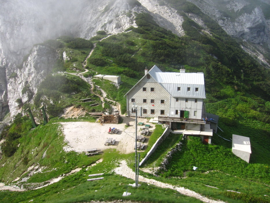
itinerario bellissimo e vario. La ferrata in discesa dalla cima non comporta gravi difficoltà, sempre sicura e segnalata. Forse ad inizio stagione lingue di neve nella conca tra il grintovec e lo Skuta.  


Further information at

http://www.hribi.net

Galerija izletov

Zemljevid in višinski profil izleta

  • Open Street Map
  • Google
Minimum height 99999 m Maximum height -99999 m Prikaz podrobnosti

More about the tour author

sioni
Member since 2015

Send private message

Komentarji

autostrada A2 lubjana Jesenice, con uscita a Vodice. Quindi seguire per Kamnik e seguire sino alla fine della strada di Bistrica

Poti GPS

Trackpoints
  • GPX / Garmin Map Source (gpx) download
  • TCX / Garmin Training Center® (tcx) download
  • CRS / Garmin Training Center® (crs) download
  • Google Earth (kml) download
  • G7ToWin (g7t) download
  • TTQV (trk) download
  • Overlay (ovl) download
  • Fugawi (txt) download
  • Kompass (DAV) Track (tk) download
  • List z izleti (pdf) download
  • Original file of the author (gpx) download

More about the tour author

sioni
Member since 2015

Send private message
Share track
Add to my favorites
Remove from my favorites
Edit tags
My score
Rate
Izlet: Grintovec anello
Vrsta: Izlet v gore
Dolžina: 12,0 km
Evaluated on:
Trajanje:
Day(s)
Hour(s)
Minute(s)
Ocena: Pokrajina Dejavnik zabave Kondicija Tehnika