


Transalp Tag 2
Von Karres (Imst) nach Nauders
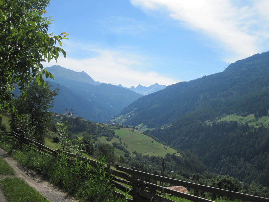
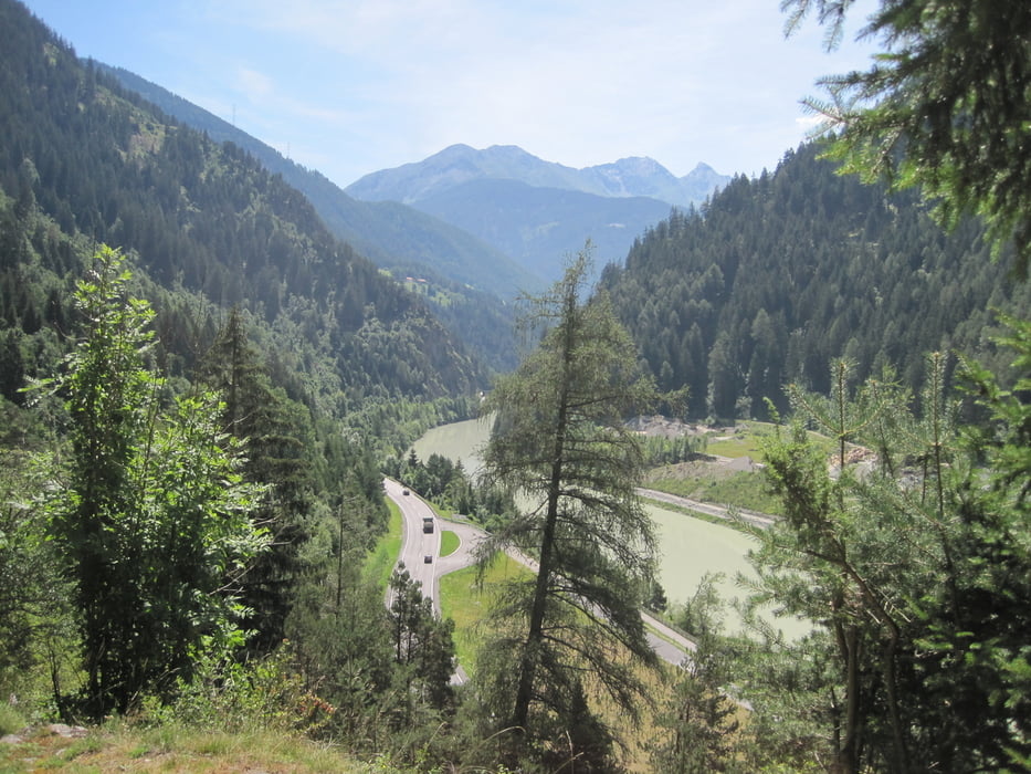
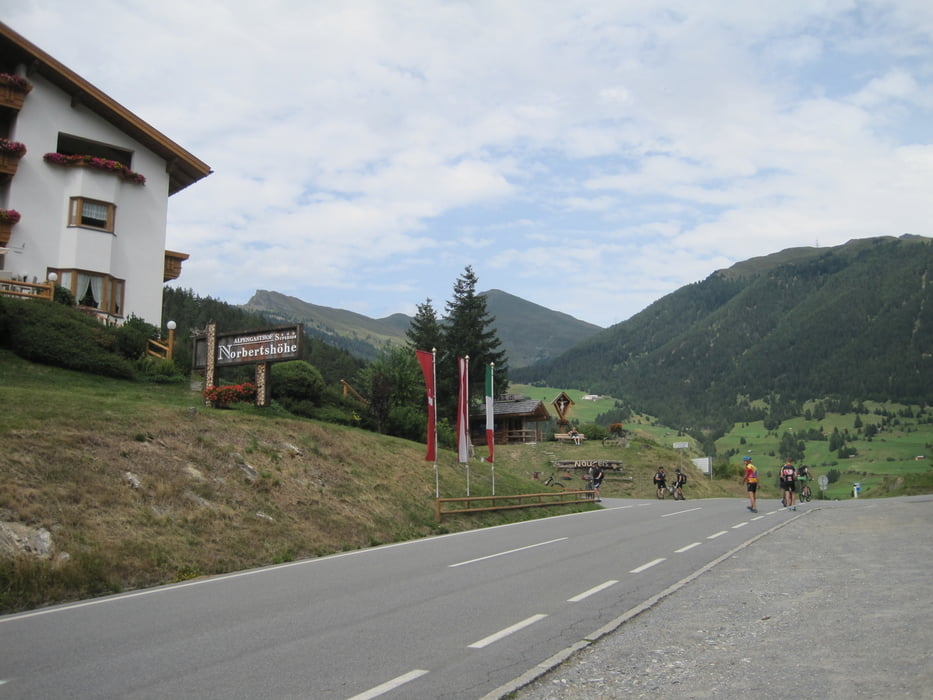
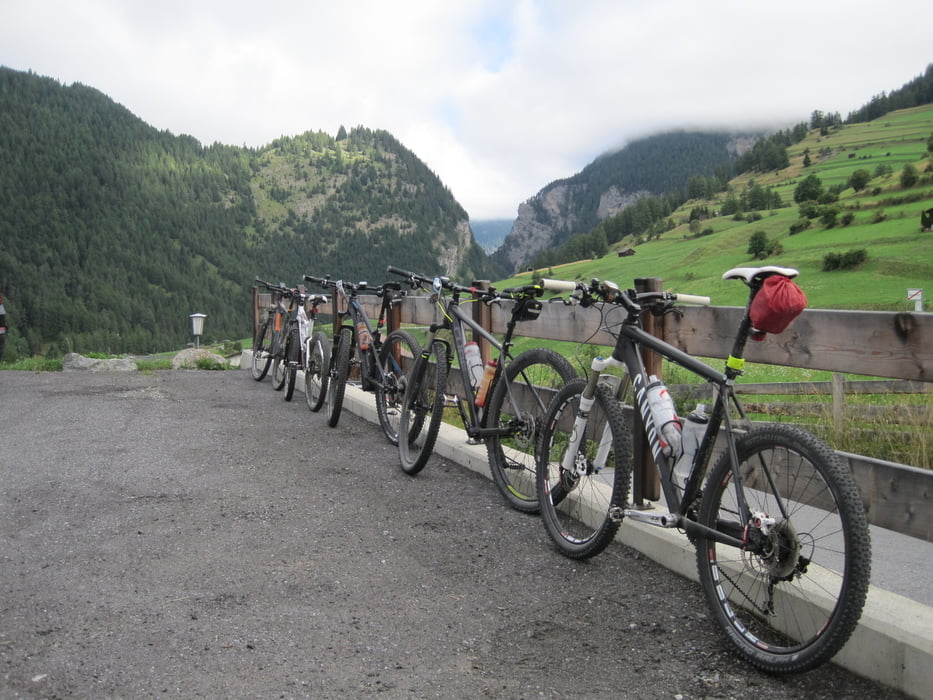
Streckenverlauf: Karres - (Inntalradwge) über Imsterberg - Schönwies - Zams - Landeck - dann rauf zum Schloß und weiter bergauf durch den Wald zur Fließerplatte1050 mNN (Teilstück mit Schieben/Tragen - Eichholz - Fließ - Inn überqueren - Prutz - Tösens - Schönegg - Maria Stein - Pfunds - Reschenstra0e bis Kajetansbrücke - dann kurz in der Schweiz über Vinadi und rasante Abfahrt nach Martina (Grenze) - es beginnt eine Serpentinenstraße (11 Kehren) bis rauf auf die Norbertshöhe (kann mach auch durch den Wald auf Schotterwegen fahren) - zum Abschluss rasante Abfahrt nach Nauders.
Start 830 m NN
Höchster Punkt Norbertshöhe 1.405 mNN
Länge ca. 74 km
reine Fahrtzeit ca. 6 Std
Das Streckenprofil ist fehlerhaft, meine Uhr zeichnete kurzfristig >1600 m auf, tatsächlich war der höchste Punkt aber 1.405 m
Somit Tageshöhenprofil (bergauf) ca. 1300 hm
Further information at
http://www.imst.at/de/karres/Galerija izletov
Zemljevid in višinski profil izleta
Minimum height 712 m
Maximum height 1614 m
More about the tour author
|
|
RobKa |
Komentarji

Ausgangspunkt ist Karres bei Imst (Etappenziel vorm Vortrag)
Poti GPS
Trackpoints-
GPX / Garmin Map Source (gpx) download
-
TCX / Garmin Training Center® (tcx) download
-
CRS / Garmin Training Center® (crs) download
-
Google Earth (kml) download
-
G7ToWin (g7t) download
-
TTQV (trk) download
-
Overlay (ovl) download
-
Fugawi (txt) download
-
Kompass (DAV) Track (tk) download
-
List z izleti (pdf) download
-
Original file of the author (tcx) download
More about the tour author
|
|
RobKa |
Add to my favorites
Remove from my favorites
Edit tags
Open track
My score
Rate