
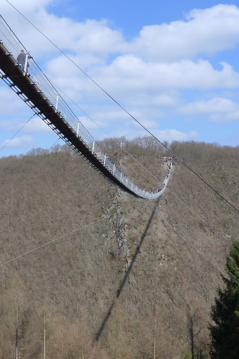

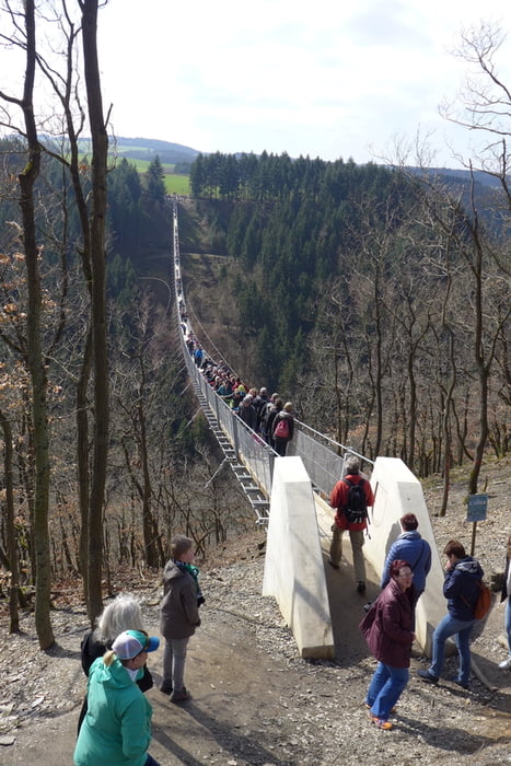
Wanderung über die längste Hängebrücke Deutschlands (360 m lang, 100 m über Grund) und entlang des idyllischen Mörsdorfer Bachs.
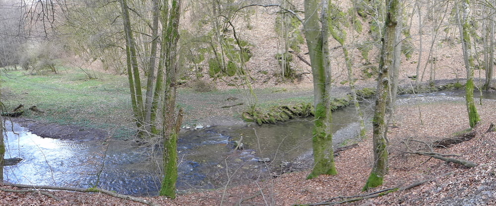
Zunächst steigt man über einen nicht so überlaufenen Seitenpfad ein und kommt so zum Brückenkopf auf der Mörsdorfer Seite. Danach gehts über die Brücke und hinunter zur Bucher Mühle. Dann entlang des Mörsdorfer Bachs bis zur Fettsmühle und wieder hinauf aus dem Tal nach Mörsdorf. (Höhenangaben des Tracks im Bereich der Brücke stimmen leider nicht).
Further information at
http://www.geierlay.de/Galerija izletov
Zemljevid in višinski profil izleta
Minimum height 224 m
Maximum height 342 m
More about the tour author

|
grenz-pfad-fahrer |
Komentarji

Start ist in Mörsdorf am Parkplatz Windorfer Str.
Poti GPS
Trackpoints-
GPX / Garmin Map Source (gpx) download
-
TCX / Garmin Training Center® (tcx) download
-
CRS / Garmin Training Center® (crs) download
-
Google Earth (kml) download
-
G7ToWin (g7t) download
-
TTQV (trk) download
-
Overlay (ovl) download
-
Fugawi (txt) download
-
Kompass (DAV) Track (tk) download
-
List z izleti (pdf) download
-
Original file of the author (gpx) download
More about the tour author
|
|
grenz-pfad-fahrer |
Add to my favorites
Remove from my favorites
Edit tags
Open track
My score
Rate