


Am Morgen wie gehabt von Homburg Schwarzenbach nach Kirkel Neuhäusel.
Am Abend rollte ich zuerst bei meinem Bäcker vorbei um dann im Kirkeler Tal in Richtung Lautzkirchen zu kullern.
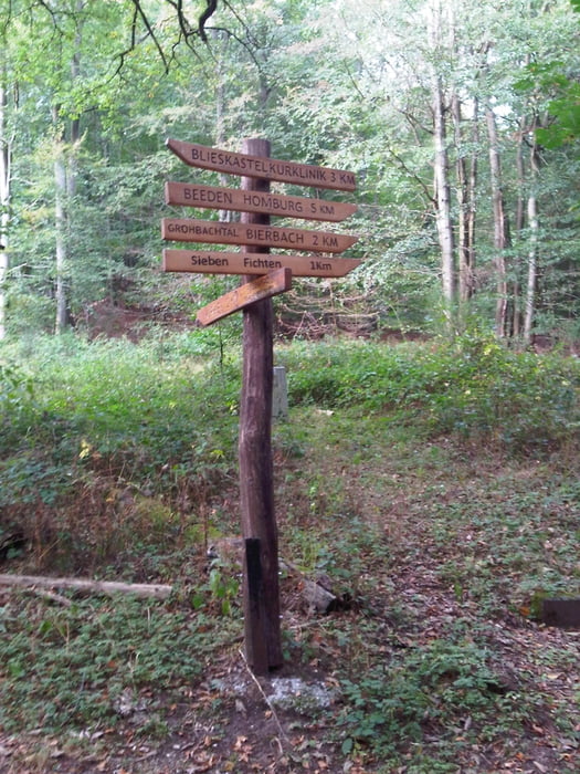
Bei den Tennisplätzen bog ich nach links ab und fuhr den rechten Weg began bis ich auf den Kammweg kam. Ich verfolgte diesen bis Peters Eiche und weiter bis zu den 7 Fichten.
Dort bog ich nach rechts den Berg hoch um säter den Weg nach links zu verlassen umdann, einige Höhenmeter tiefer den tollen Trial durch die Flanke zu fahren.
Ich erreichte das Taubental und fuhr auf der gewohneten Strecke zum Ausgangspunkt zurück.
Am Abend rollte ich zuerst bei meinem Bäcker vorbei um dann im Kirkeler Tal in Richtung Lautzkirchen zu kullern.
Bei den Tennisplätzen bog ich nach links ab und fuhr den rechten Weg began bis ich auf den Kammweg kam. Ich verfolgte diesen bis Peters Eiche und weiter bis zu den 7 Fichten.
Dort bog ich nach rechts den Berg hoch um säter den Weg nach links zu verlassen umdann, einige Höhenmeter tiefer den tollen Trial durch die Flanke zu fahren.
Ich erreichte das Taubental und fuhr auf der gewohneten Strecke zum Ausgangspunkt zurück.
Further information at
https://de.wikipedia.org/wiki/Sankt_Ingbert-Kirkeler_WaldgebietGalerija izletov
Zemljevid in višinski profil izleta
Minimum height 227 m
Maximum height 387 m
More about the tour author
|
|
Pheinz |
Komentarji

Start und Ziel in Homburg Schwarzenbach.
Poti GPS
Trackpoints-
GPX / Garmin Map Source (gpx) download
-
TCX / Garmin Training Center® (tcx) download
-
CRS / Garmin Training Center® (crs) download
-
Google Earth (kml) download
-
G7ToWin (g7t) download
-
TTQV (trk) download
-
Overlay (ovl) download
-
Fugawi (txt) download
-
Kompass (DAV) Track (tk) download
-
List z izleti (pdf) download
-
Original file of the author (gpx) download
More about the tour author
|
|
Pheinz |
Add to my favorites
Remove from my favorites
Edit tags
Open track
My score
Rate