


Die Tour startet (am Campingplatz Le Capanne) in Bibbona.
Von dort erstmal gemütliches Kurbeln durch die toskanische Landschaft auf Feld/Schotterwegen oder später auch auf einsamen Landstrassen, durch die netten Orte Bibbona und Casale Marittimo
In Gabella beginnt dann der sehr dankbare Anstieg (Achtung, auch letzte Espressobar) hoch nach Sasso, ab Sasso dann steiler auf Schotter bis zum Poggio al Pruno.
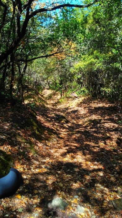
Von dort wartet dann das Highlight: Downhill auf einem lupenreinen Genusstrail, angelegt vom MTB Club Cecina. War wohl Teil des Bike Marathon del Tirreno.
Schwierigkeit meist S1, manchmal S2 (geschätzt), alles fahrbar.
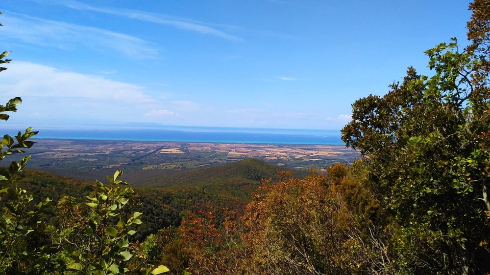
Man wird 500 Hm später wieder bei Bolgheri ausgespuckt, von dort Gelegenheit zu einem touristischen Abstecher zur berühmten Zypressenallee.
wunderbare Halbtagestour.
Galerija izletov
Zemljevid in višinski profil izleta
Minimum height 9 m
Maximum height 605 m
More about the tour author

|
magsegum |
Komentarji
Poti GPS
Trackpoints-
GPX / Garmin Map Source (gpx) download
-
TCX / Garmin Training Center® (tcx) download
-
CRS / Garmin Training Center® (crs) download
-
Google Earth (kml) download
-
G7ToWin (g7t) download
-
TTQV (trk) download
-
Overlay (ovl) download
-
Fugawi (txt) download
-
Kompass (DAV) Track (tk) download
-
List z izleti (pdf) download
-
Original file of the author (gpx) download
More about the tour author
|
|
magsegum |
Add to my favorites
Remove from my favorites
Edit tags
Open track
My score
Rate
auf der Durchfahrt
Danke fürs teilen
GT