Login

Si pozabil/a podatke za prijavo?

Cookies have to be accepted!
Your browser's cookie functionality is disabled. Please enable this functionality.

Not a member yet?

Register now
Login

Available for registred users only

Log in to use this feature.

Si pozabil/a podatke za prijavo?

Cookies have to be accepted!
Your browser's cookie functionality is disabled. Please enable this functionality.

Not a member yet?

Register now
Filter
Kategorije
Advanced filters
  • Dolžina (km)
  • Metri nadmorske višine
Shrani filter Reset filter

TrackRank

QRCode

Technical data

Dolžina17,2 km Metri nadmorske višine1089 m Way down1093 m Trajanje05:45 h:m Datum10.02.2022
Ocene Author Pokrajina Dejavnik zabave Kondicija Tehnika

Statistika

70 Pogledi Ocene 0 Prenosi Povprečje
Rate
  • List z izleti
  • Prihod
  • Prenosi
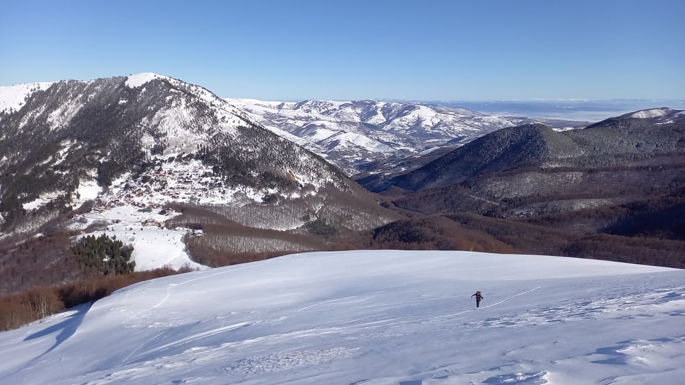
Ein kurzes Stück der zugeschneiten Fahrstraße folgen, dann leicht links über schöne Böden hinauf. Über den rücken weiter bis zu kleiner Einsattelung. Hier rechts leicht fallend in das Becken queren, dabei auf Schneebrettgefahr achten. Aus dem Becken entweder über den Sommerweg oder angenehmer und sicherer nach Westen durch die Mulde ansteigen bis zum Gipfelgrat. Über diesen, bei hartem Schnee zuletzt unangenehm bis zum Gipfel. Abfahrt wie Aufstieg. Wer noch Energie hat, könnte vom Gipfel auch noch eine Firn?abfahrt nach Süden mit anschließendem Wiederaufstieg dranhängen

Galerija izletov

Zemljevid in višinski profil izleta

  • Open Street Map
  • Google
Minimum height 1540 m Maximum height 2593 m Prikaz podrobnosti

More about the tour author

Gi
Member since 2010

Send private message

Komentarji

Von der Passhöhe Prevalla hinauf zum empfehlenswereten Hotel Krojet. Kurz dahinter Parkplatz. Bei schlechtem Straßenzustand an der Passhöhe parken.

Poti GPS

Trackpoints
  • GPX / Garmin Map Source (gpx) download
  • TCX / Garmin Training Center® (tcx) download
  • CRS / Garmin Training Center® (crs) download
  • Google Earth (kml) download
  • G7ToWin (g7t) download
  • TTQV (trk) download
  • Overlay (ovl) download
  • Fugawi (txt) download
  • Kompass (DAV) Track (tk) download
  • List z izleti (pdf) download
  • Original file of the author (gpx) download

More about the tour author

Gi
Member since 2010

Send private message
Share track
Add to my favorites
Remove from my favorites
Edit tags
My score
Rate
Izlet: Konjushka
Vrsta: Smuči
Dolžina: 17,2 km
Evaluated on:
Trajanje:
Day(s)
Hour(s)
Minute(s)
Ocena: Pokrajina Dejavnik zabave Kondicija Tehnika