Login

Si pozabil/a podatke za prijavo?

Cookies have to be accepted!
Your browser's cookie functionality is disabled. Please enable this functionality.

Not a member yet?

Register now
Login

Available for registred users only

Log in to use this feature.

Si pozabil/a podatke za prijavo?

Cookies have to be accepted!
Your browser's cookie functionality is disabled. Please enable this functionality.

Not a member yet?

Register now
Filter
Kategorije
Advanced filters
  • Dolžina (km)
  • Metri nadmorske višine
Shrani filter Reset filter

TrackRank

QRCode

Technical data

Dolžina16,8 km Metri nadmorske višine1493 m Way down1498 m Trajanje05:00 h:m Datum18.02.2022
Ocene Author Pokrajina Dejavnik zabave Kondicija Tehnika

Statistika

79 Pogledi Ocene 0 Prenosi Povprečje
Rate
  • List z izleti
  • Prihod
  • Prenosi
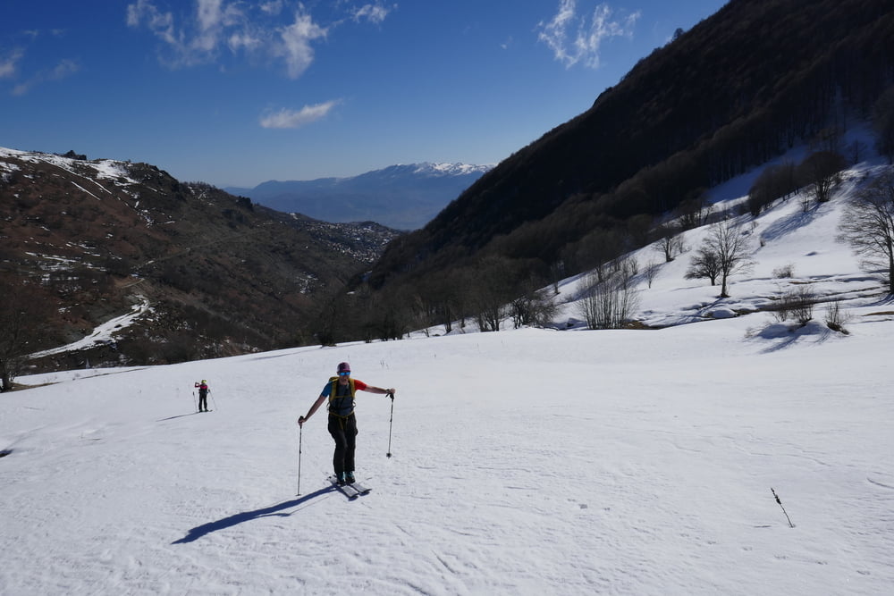
Von Novo Celo zunächst an einem Schafstall entlang auf Fahrweg bis über Brücke über den Bogowitska Bach. hier hat bei uns der Schnee angefangen. Nun rechts des Fahrwegs hinauf dann zunächst etwas flacher nach Westen. Dann wieder steiler werdend in leichtem Rechtsbogen auf den Gipfel. Abfahrt wie Aufstieg

Galerija izletov

Zemljevid in višinski profil izleta

  • Open Street Map
  • Google
Minimum height 1211 m Maximum height 2711 m Prikaz podrobnosti

More about the tour author

Gi
Member since 2010

Send private message

Komentarji

von Tetovo über die Autobahn eine Ausfahrt nach Süden, und über die R1206 weiter nach süden bis zur Abzweigung nach Novo Celo. In Novo Celo allerhöchstens Parkmöglichkeit für ein Auto. Besser schon beim UCK Denkmal vor der Otschaft parken!

Poti GPS

Trackpoints
  • GPX / Garmin Map Source (gpx) download
  • TCX / Garmin Training Center® (tcx) download
  • CRS / Garmin Training Center® (crs) download
  • Google Earth (kml) download
  • G7ToWin (g7t) download
  • TTQV (trk) download
  • Overlay (ovl) download
  • Fugawi (txt) download
  • Kompass (DAV) Track (tk) download
  • List z izleti (pdf) download
  • Original file of the author (gpx) download

More about the tour author

Gi
Member since 2010

Send private message
Share track
Add to my favorites
Remove from my favorites
Edit tags
My score
Rate
Izlet: Borislawec
Vrsta: Smuči
Dolžina: 16,8 km
Evaluated on:
Trajanje:
Day(s)
Hour(s)
Minute(s)
Ocena: Pokrajina Dejavnik zabave Kondicija Tehnika