


Tour im Rekordschneejahr 2023, in normalen Jahren gleiche Verhältnisse eher 2-4 Wochen früher.
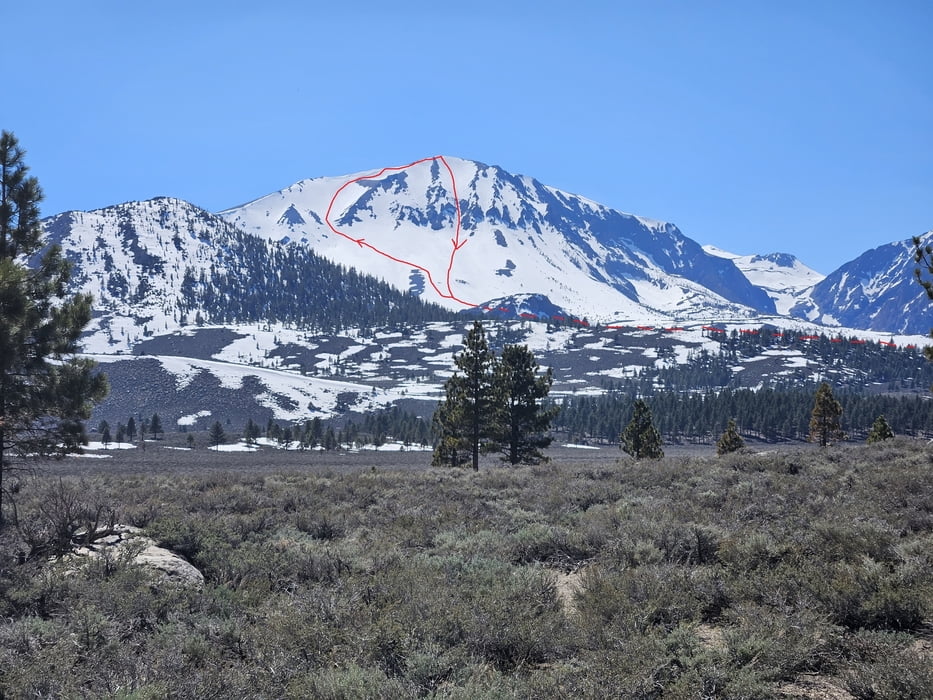
Perfekter Skiberg, wegen ostseitiger Ausrichtung früher Aufbruch ratsam.
Die Bachrinne entlang aufsteigen. Unsere Aufstiegsvariante im oberen Teil führte zu einem freigeblasenen Rücken, deshalb besser dem Abfahrtstrack durch die Rinne folgen. Über den breiten Bergfuß diagonal zur breiten Rinne/Flanke links des Gipfels, die den einfachsten und flachsten Aufstieg darstellt. Am Schluss über den Grat zum Gipfel. Abfahrt direkt durch das Couloir das vom Gipfel hinabzieht.
Galerija izletov

Zemljevid in višinski profil izleta
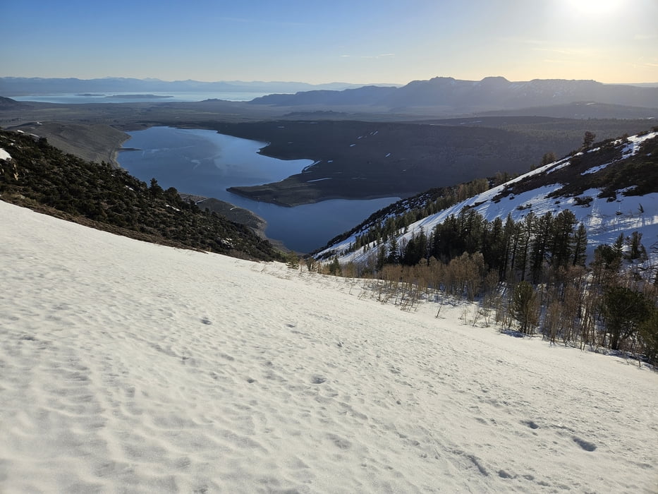
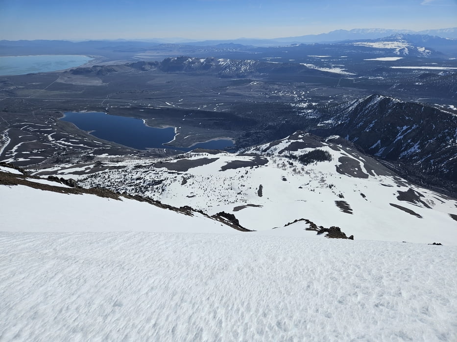
Minimum height 2184 m
Maximum height 3762 m
More about the tour author

|
Gi |
Komentarji

Von Mammoth auf der US 395 nach Norden bis zur Abzweigung June Lakes Loop. Auf dieser bis zu Parkmöglichkeit rechts der Straße am Anfang des Grant Lakes, wo links ein Bach mit einer - zumindest weiter oben Schneegefüllten Rinne herunterkommt. Die Rinne erkennt man besser von Norden kommend.
Poti GPS
Trackpoints-
GPX / Garmin Map Source (gpx) download
-
TCX / Garmin Training Center® (tcx) download
-
CRS / Garmin Training Center® (crs) download
-
Google Earth (kml) download
-
G7ToWin (g7t) download
-
TTQV (trk) download
-
Overlay (ovl) download
-
Fugawi (txt) download
-
Kompass (DAV) Track (tk) download
-
List z izleti (pdf) download
-
Original file of the author (gpx) download
More about the tour author
|
|
Gi |
Add to my favorites
Remove from my favorites
Edit tags
Open track
My score
Rate