


Schneeschuhtour durch teilweise unberührtes Gelände.
Zunächst den Fahrweg Richtung Bergli folgen, kurz vor dem Gasthof geht es ins Gelände; teils über Wiesen, teils über Waldwege bis zum Gasthof Fuchsacker. Nach einer Stärkung den Weg wieder ca. 150 m zurück und dann erkennt man kaum den links abgehenden, unscheinbaren Trampelpfad, den man talabwärts folgt. Nach ca. 150 m geht es unterhalb eines kleinen Wasserfalls über einen Bach - bei ungünstigen Schneeverhältnissen kann man sich hier nasse Füsse holen ;-)
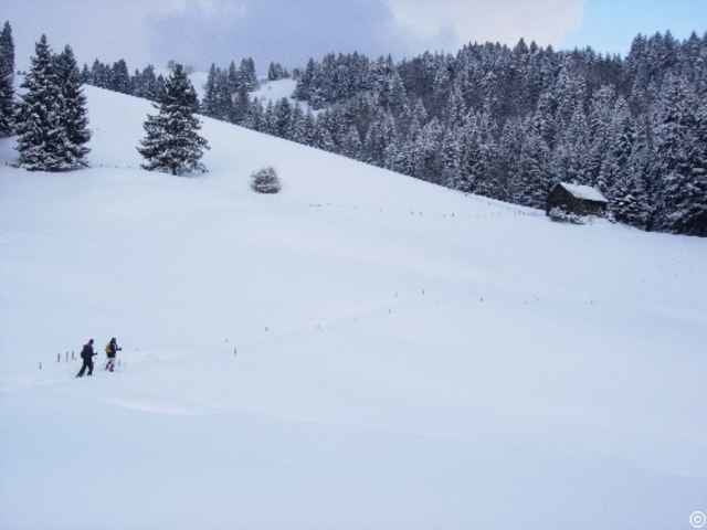
Man erreicht einen Bauernhof, von dort über den Fahrweg hinunter ins Rippistal - eine völlig verschlafene Ecke, wohin sich kaum jemand verirrt.
Am tiefsten Punkt steigt man auf einem Bergrücken Richtung Süden und steigt an der Alp Gschwend vorbei durch offenens Gelände wieder zum Parkplatz.
Zunächst den Fahrweg Richtung Bergli folgen, kurz vor dem Gasthof geht es ins Gelände; teils über Wiesen, teils über Waldwege bis zum Gasthof Fuchsacker. Nach einer Stärkung den Weg wieder ca. 150 m zurück und dann erkennt man kaum den links abgehenden, unscheinbaren Trampelpfad, den man talabwärts folgt. Nach ca. 150 m geht es unterhalb eines kleinen Wasserfalls über einen Bach - bei ungünstigen Schneeverhältnissen kann man sich hier nasse Füsse holen ;-)
Man erreicht einen Bauernhof, von dort über den Fahrweg hinunter ins Rippistal - eine völlig verschlafene Ecke, wohin sich kaum jemand verirrt.
Am tiefsten Punkt steigt man auf einem Bergrücken Richtung Süden und steigt an der Alp Gschwend vorbei durch offenens Gelände wieder zum Parkplatz.
Galerija izletov
Zemljevid in višinski profil izleta
Minimum height 755 m
Maximum height 1062 m
More about the tour author

|
schmirk |
Komentarji

Schwellbrunn Richtung Dicken, hinter Gasthof Landscheidi schräg rechts ab bis zum Fahrverbot, dort ist der Parkplatz vom Gasthof Bergli.
Poti GPS
Trackpoints-
GPX / Garmin Map Source (gpx) download
-
TCX / Garmin Training Center® (tcx) download
-
CRS / Garmin Training Center® (crs) download
-
Google Earth (kml) download
-
G7ToWin (g7t) download
-
TTQV (trk) download
-
Overlay (ovl) download
-
Fugawi (txt) download
-
Kompass (DAV) Track (tk) download
-
List z izleti (pdf) download
-
Original file of the author (g7t) download
More about the tour author
|
|
schmirk |
Add to my favorites
Remove from my favorites
Edit tags
Open track
My score
Rate