Login

Si pozabil/a podatke za prijavo?

Cookies have to be accepted!
Your browser's cookie functionality is disabled. Please enable this functionality.

Not a member yet?

Register now
Login

Available for registred users only

Log in to use this feature.

Si pozabil/a podatke za prijavo?

Cookies have to be accepted!
Your browser's cookie functionality is disabled. Please enable this functionality.

Not a member yet?

Register now
Filter
Kategorije
Advanced filters
  • Dolžina (km)
  • Metri nadmorske višine
Shrani filter Reset filter

TrackRank

QRCode

Technical data

Dolžina96,6 km Metri nadmorske višine2916 m Way down2928 m Trajanje1 day 16 h Datum15.04.2006
Ocene Author Pokrajina Dejavnik zabave Kondicija Tehnika

Statistika

5747 Pogledi 1 Ocena 956 Prenosi 3.00 Povprečje
Rate
  • List z izleti
  • Prihod
  • Prenosi
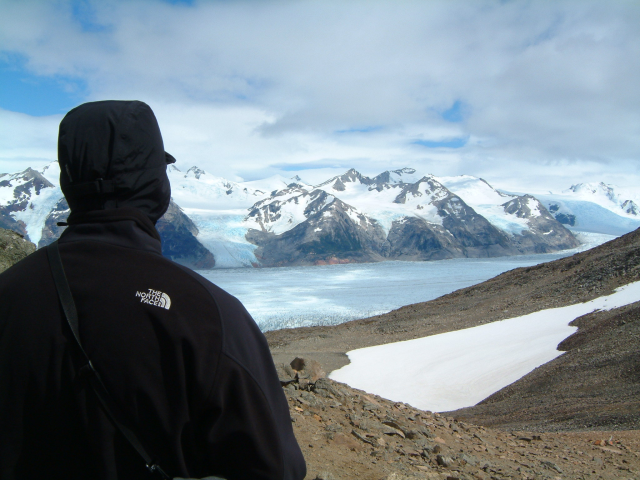
Umrundung des Bergmassiv Torres del Paine von der trockenen Grassteppe durch Wald und Hochland-Moor in andines Gelände, vorbei am Gletscher Grey.

Further information at

http://de.wikipedia.org/wiki/Torres_del_Paine

Galerija izletov

Zemljevid in višinski profil izleta

  • Open Street Map
  • Google
Minimum height 25 m Maximum height 1187 m Prikaz podrobnosti

More about the tour author

Toaster
Member since 2005

Send private message

Komentarji

Poti GPS

Trackpoints
  • GPX / Garmin Map Source (gpx) download
  • TCX / Garmin Training Center® (tcx) download
  • CRS / Garmin Training Center® (crs) download
  • Google Earth (kml) download
  • G7ToWin (g7t) download
  • TTQV (trk) download
  • Overlay (ovl) download
  • Fugawi (txt) download
  • Kompass (DAV) Track (tk) download
  • List z izleti (pdf) download
  • Original file of the author (gpx) download

More about the tour author

Toaster
Member since 2005

Send private message
Share track
Add to my favorites
Remove from my favorites
Edit tags
My score
Rate
Izlet: Circuit Torres del Paine
Vrsta: Izlet v gore
Dolžina: 96,6 km
Evaluated on:
Trajanje:
Day(s)
Hour(s)
Minute(s)
Ocena: Pokrajina Dejavnik zabave Kondicija Tehnika