Login

Si pozabil/a podatke za prijavo?

Cookies have to be accepted!
Your browser's cookie functionality is disabled. Please enable this functionality.

Not a member yet?

Register now
Login

Available for registred users only

Log in to use this feature.

Si pozabil/a podatke za prijavo?

Cookies have to be accepted!
Your browser's cookie functionality is disabled. Please enable this functionality.

Not a member yet?

Register now
Filter
Kategorije
Advanced filters
  • Dolžina (km)
  • Metri nadmorske višine
Shrani filter Reset filter

TrackRank

QRCode

Technical data

Dolžina9,3 km Metri nadmorske višine504 m Way down455 m Trajanje02:10 h:m Datum27.10.2006
Ocene Author Pokrajina Dejavnik zabave Kondicija Tehnika

Statistika

890 Pogledi Ocene 68 Prenosi Povprečje
Rate
  • List z izleti
  • Prihod
  • Prenosi
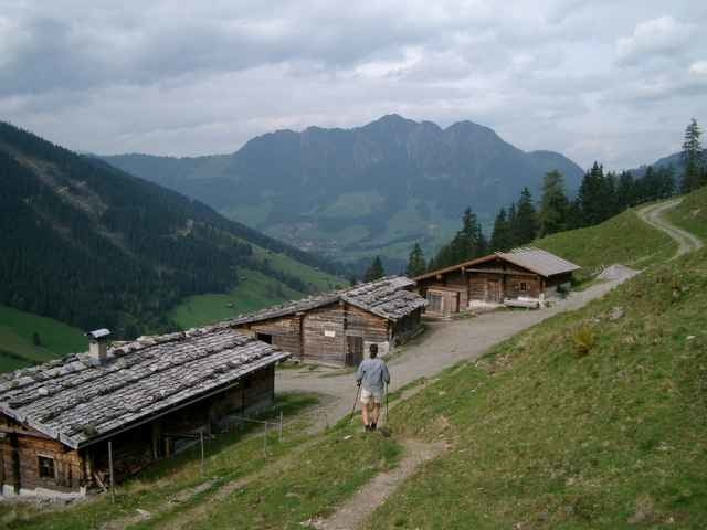
vom Parkplatz Inneralpbach neben dem Lift geht die Forststraße stetig bergauf vorbei an der Niederalm und dann in Serpentinen zur Farmkehralm 1521m mit Blick zum Wiedesberger Horn. Der Rückweg führt hoch im Tal an der Stettauer Alm und der Waldkapelle von Inneralpbach vorbei zurück zum Parkplatz.

Galerija izletov

Zemljevid in višinski profil izleta

  • Open Street Map
  • Google
Minimum height 587 m Maximum height 1509 m Prikaz podrobnosti

More about the tour author

bergkine
Member since 2005

Send private message

Komentarji

Die Autobahn München-Innsbruck bei der Ausfahrt Kramsach verlassen weiter über Brixlegg nach Inneralpbach

Poti GPS

Trackpoints
  • GPX / Garmin Map Source (gpx) download
  • TCX / Garmin Training Center® (tcx) download
  • CRS / Garmin Training Center® (crs) download
  • Google Earth (kml) download
  • G7ToWin (g7t) download
  • TTQV (trk) download
  • Overlay (ovl) download
  • Fugawi (txt) download
  • Kompass (DAV) Track (tk) download
  • List z izleti (pdf) download
  • Original file of the author (g7t) download

More about the tour author

bergkine
Member since 2005

Send private message
Share track
Add to my favorites
Remove from my favorites
Edit tags
My score
Rate
Izlet: Farmkehr-Hochalm
Vrsta: Nordijska hoja
Dolžina: 9,3 km
Evaluated on:
Trajanje:
Day(s)
Hour(s)
Minute(s)
Ocena: Pokrajina Dejavnik zabave Kondicija Tehnika