Login

Si pozabil/a podatke za prijavo?

Cookies have to be accepted!
Your browser's cookie functionality is disabled. Please enable this functionality.

Not a member yet?

Register now
Login

Available for registred users only

Log in to use this feature.

Si pozabil/a podatke za prijavo?

Cookies have to be accepted!
Your browser's cookie functionality is disabled. Please enable this functionality.

Not a member yet?

Register now
Filter
Kategorije
Advanced filters
  • Dolžina (km)
  • Metri nadmorske višine
Shrani filter Reset filter

TrackRank

QRCode

Technical data

Dolžina10,7 km Metri nadmorske višine1190 m Way down639 m Trajanje04:30 h:m Datum10.07.2007
Ocene Author Pokrajina Dejavnik zabave Kondicija Tehnika

Statistika

3130 Pogledi Ocene 318 Prenosi Povprečje
Rate
  • List z izleti
  • Prihod
  • Prenosi
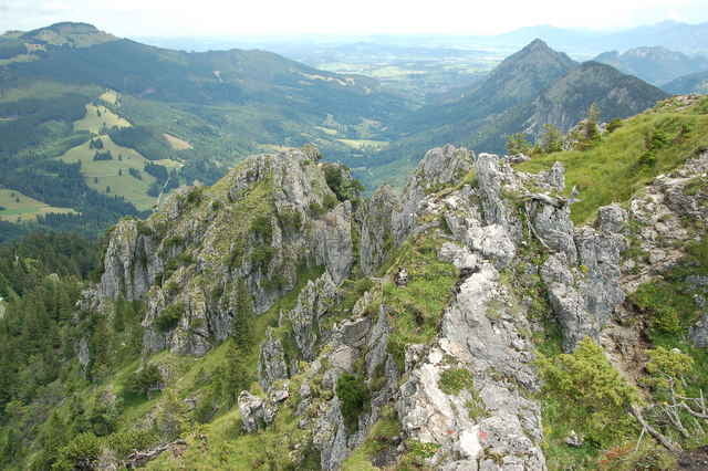
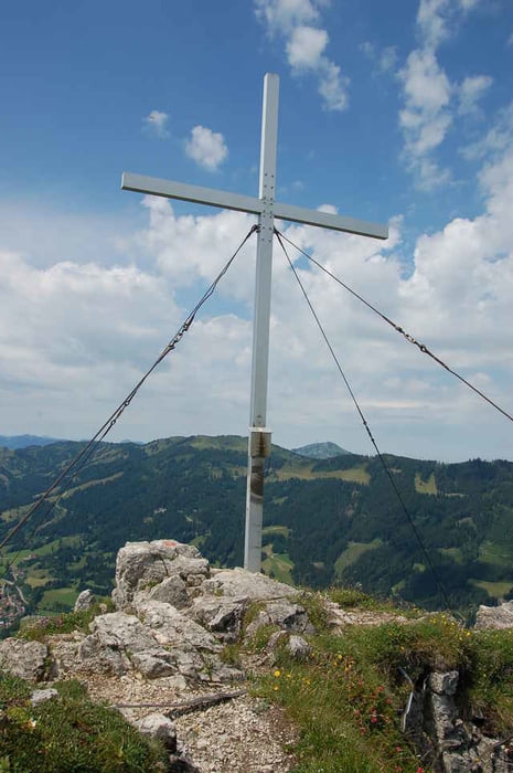
Toller nicht besonders anspruchsvoller Klettersteig mit fantastischen Ausblicken.

Galerija izletov

Zemljevid in višinski profil izleta

  • Open Street Map
  • Google
Minimum height 492 m Maximum height 1637 m Prikaz podrobnosti

More about the tour author

a.bocks
Member since 2007

Send private message

Komentarji

BerndSi on 12.05.2009

Schaut gut aus
Ich werde es im Juni testen wenn ich im Unterjoch in Urlaub bin
Trailhunter-Joe on 05.09.2009

gelegentliche Seile im Wegverlauf, daher kein Klettersteig
Von Ulm A7 Richtung Kempten. Ausfahrt "Oy-Mittelberg". Dann Richtung Jungholz und Unterjoch. Parkplatz direkt rechts vor Ortseingang Unterjoch.

Poti GPS

Trackpoints
  • GPX / Garmin Map Source (gpx) download
  • TCX / Garmin Training Center® (tcx) download
  • CRS / Garmin Training Center® (crs) download
  • Google Earth (kml) download
  • G7ToWin (g7t) download
  • TTQV (trk) download
  • Overlay (ovl) download
  • Fugawi (txt) download
  • Kompass (DAV) Track (tk) download
  • List z izleti (pdf) download
  • Original file of the author (g7t) download

More about the tour author

a.bocks
Member since 2007

Send private message
Share track
Add to my favorites
Remove from my favorites
Edit tags
My score
Rate
Izlet: Zipfel und Sorgschrofen
Vrsta: Plezalna pot
Dolžina: 10,7 km
Evaluated on:
Trajanje:
Day(s)
Hour(s)
Minute(s)
Ocena: Pokrajina Dejavnik zabave Kondicija Tehnika