Login

Zapomniałeś swój login?

Cookies have to be accepted!
Your browser's cookie functionality is disabled. Please enable this functionality.

Not a member yet?

Register now
Login

Available for registred users only

Log in to use this feature.

Zapomniałeś swój login?

Cookies have to be accepted!
Your browser's cookie functionality is disabled. Please enable this functionality.

Not a member yet?

Register now
Filter
Kategorie
Advanced filters
  • Długość (km)
  • Wysokość
Zapisz filtr Reset filter

TrackRank

QRCode

Technical data

Długość34,0 km Wysokość622 m Way down613 m Czas trwania00:00 h:m Data06.11.2010
Oceny Author Krajobraz Czynnik zadowolenia Kondycja Technika

Statystyka

701 Widoki Oceny 147 Downloads / Pliki do pobrania Przeciętnie
Rate
  • Karta trasy
  • Dojazd
  • Downloads / Pliki do pobrania

Die Beschreibung ähnelt der kurzen Pano Tour.

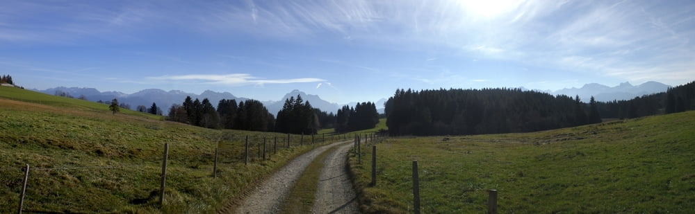
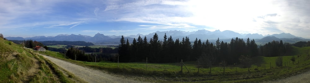
Ich find sie eine wundervolle Tour mit eben wahnsinnigem Pano.

Die Tour eignet sich eher bedingt zum nachfahren. Leider hab ich mich ein paar mal verfahren.

Die eigentliche Änderung der Route findet nach dem Hopfensee statt.  Man bleibt einfach auf der Hauptstraße und fährt eben nicht die 37%ige Steigung hoch.

Galeria trasy

Mapa trasy i profil wysokości

  • Open Street Map
  • Google
Minimum height 798 m Maximum height 984 m Widok szczegółowy

More about the tour author

DieterK
Member since 2010

Send private message

Komentarze

GPS tracks

Trackpoints
  • GPX / Garmin Map Source (gpx) download
  • TCX / Garmin Training Center® (tcx) download
  • CRS / Garmin Training Center® (crs) download
  • Google Earth (kml) download
  • G7ToWin (g7t) download
  • TTQV (trk) download
  • Overlay (ovl) download
  • Fugawi (txt) download
  • Kompass (DAV) Track (tk) download
  • Karta trasy (pdf) download
  • Original file of the author (gpx) download

More about the tour author

DieterK
Member since 2010

Send private message
Share track
Add to my favorites
Remove from my favorites
Edit tags
My score
Rate
Trasa: Allgäu Panoramatour Light
Rodzaj: Rower górski (MTB)
Długość: 34,0 km
Evaluated on:
Czas trwania:
Day(s)
Hour(s)
Minute(s)
Ocena: Krajobraz Czynnik zadowolenia Kondycja Technika